A14 Improvement Scheme - Board 9 Fen Drayton
Description
The A14 Cambridge to Huntingdon Improvement Scheme was led by MOLA-Headland Infrastructure (a consortium of Museum of London Archaeology and Headland Archaeology) and was funded by National Highways. These interpretation boards were installed by Cambridgeshire County Council with Oxford Archaeology East as part of a project funded by National Highways.
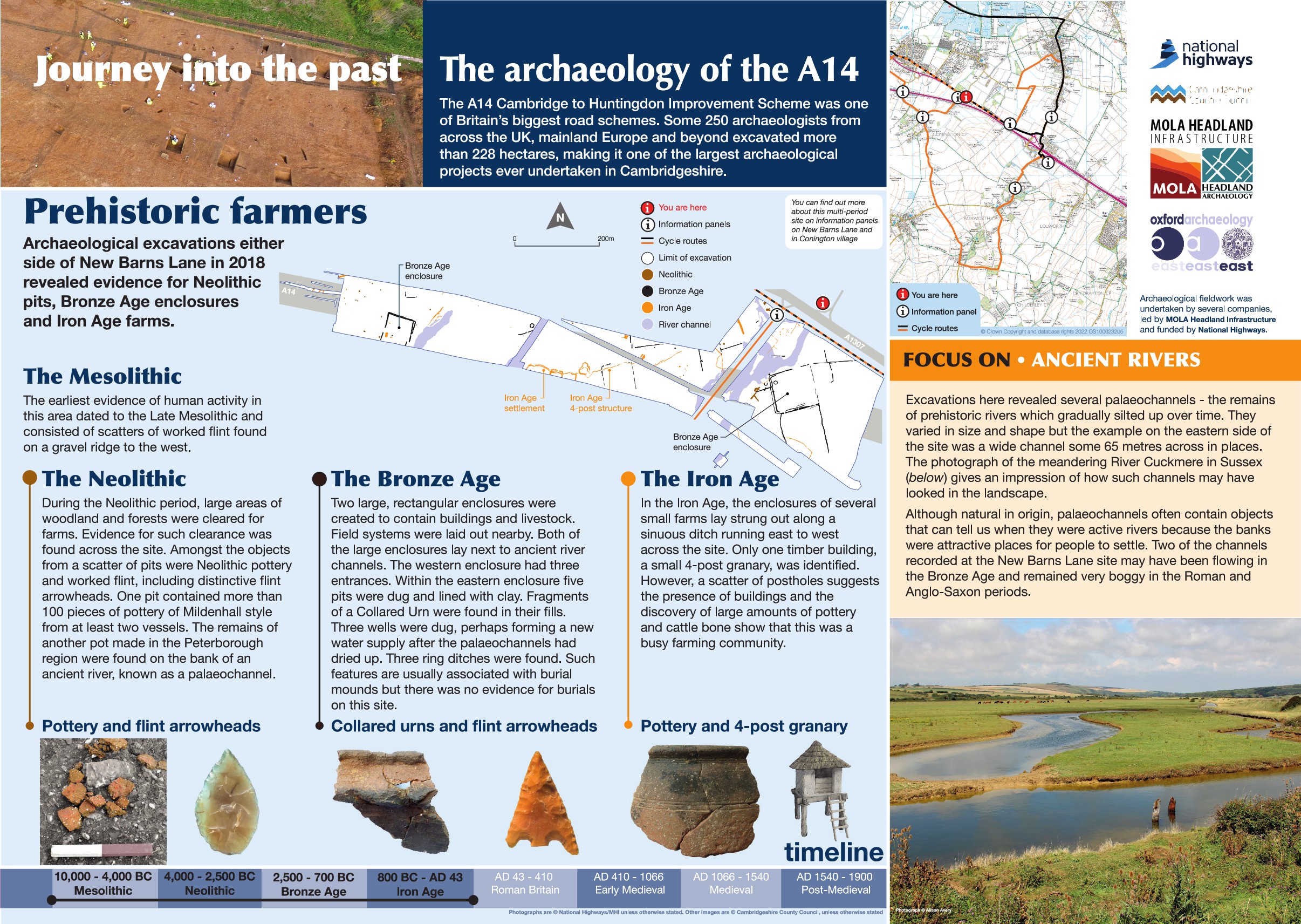
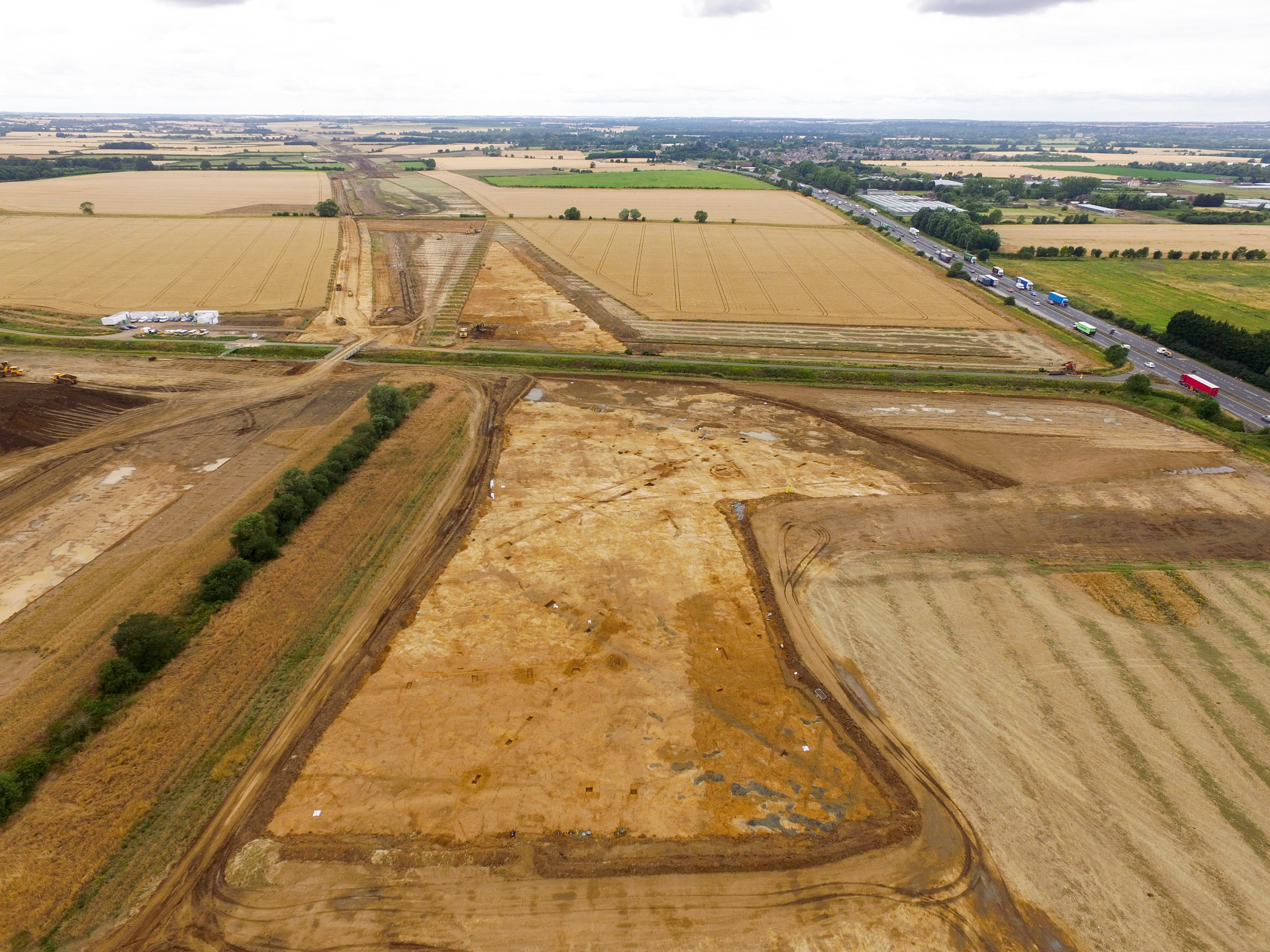
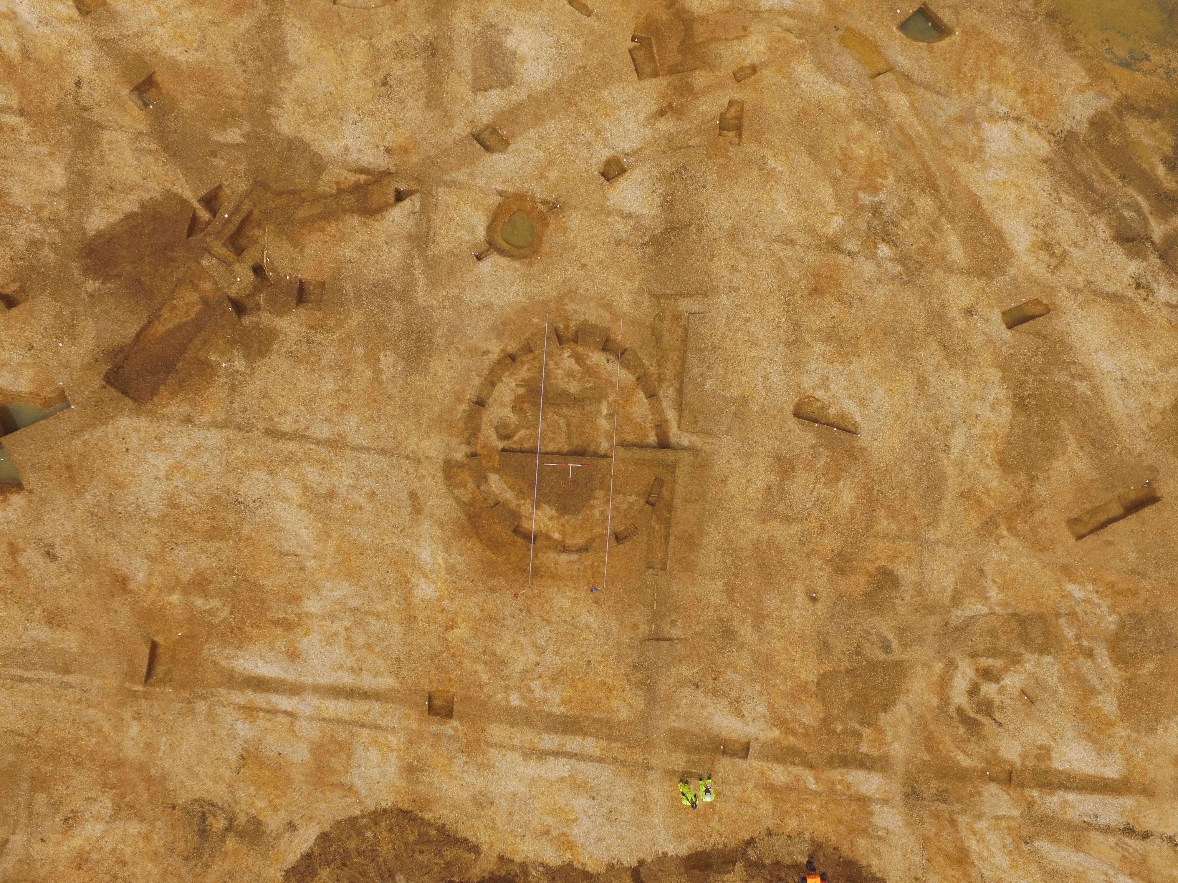
Archaeological excavations south of the road revealed evidence of Mesolithic to Neolithic, Bronze Age and Iron Age activity. The earliest evidence on site included Mesolithic flint finds and Neolithic pits and ditches. Bronze Age activity was more extensive with the first sign of intensified land use. A substantial rectangular enclosure with a double ditch boundary was identified to the east with a second, smaller enclosure recorded at the western end of the excavation area. Other enclosures were recorded across the site along with ring ditches and pits. The evidence suggests settlement, farming and possibly burial activities in the area.
Iron Age activity included a 'string' settlement, so called because it comprises with a long east-west aligned ditch with a series of smaller enclosures attached to it. Although only one structure was encountered, numerous post holes suggest the presence of other buildings nearby. Finds recorded from this phase of activity included large quantities of cattle bone and pottery, suggesting this was a busy farming community.
Find out more
Cambridgeshire Historic Environment Records
Bronze Age field systems & ring ditches and medieval to post medieval enclosure, Conington
Bronze Age and Roman enclosures, Conington
Online project archive
A14 Cambridge to Huntingdon Improvement Scheme
A14 Road Trip to the past storymap
News


