A14 Improvement Scheme - Board 11 Conington monolith
Description
The A14 Cambridge to Huntingdon Improvement Scheme was led by MOLA-Headland Infrastructure (a consortium of Museum of London Archaeology and Headland Archaeology) and was funded by National Highways. These interpretation boards were installed by Cambridgeshire County Council with Oxford Archaeology East as part of a project funded by National Highways.
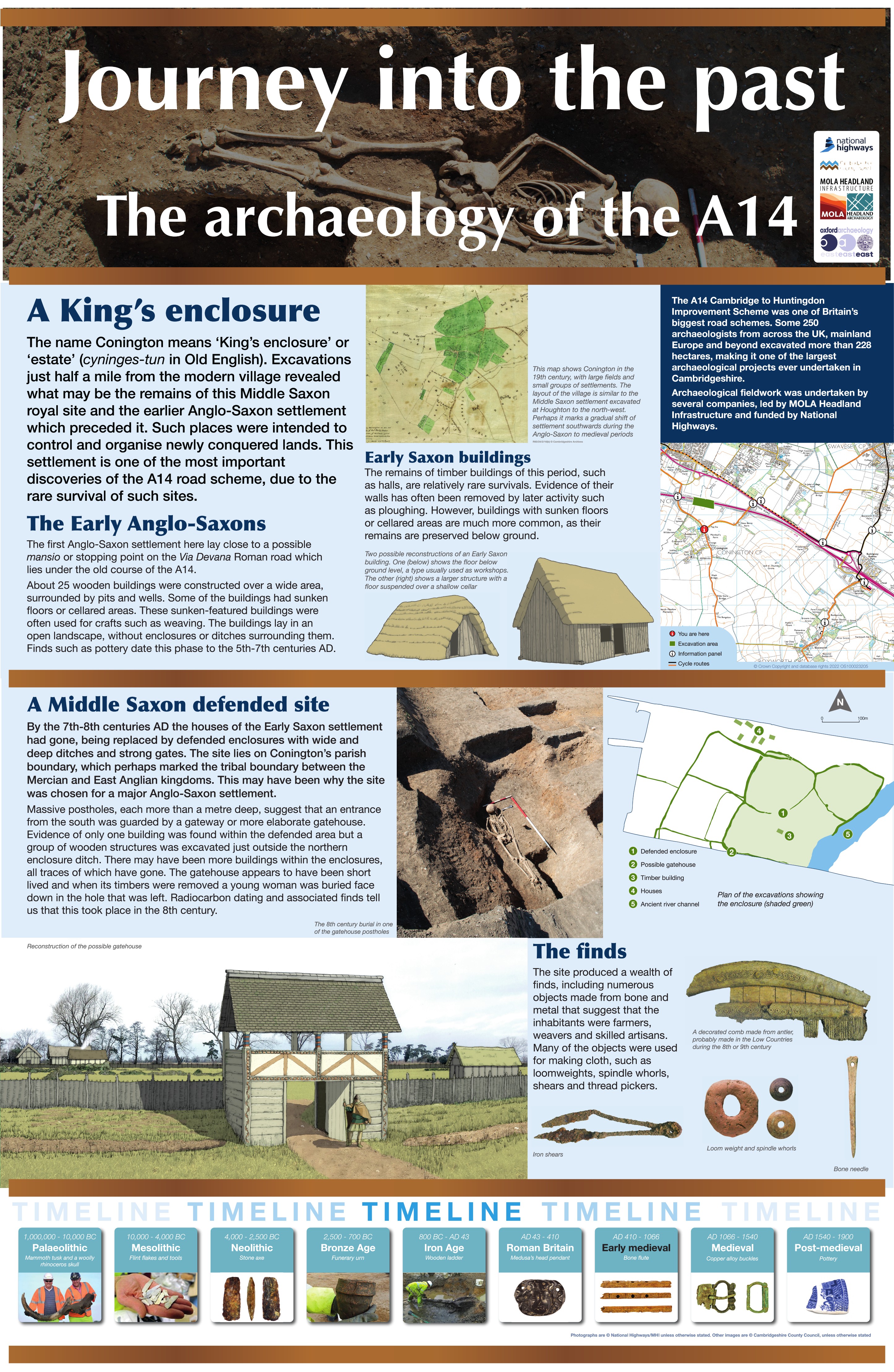
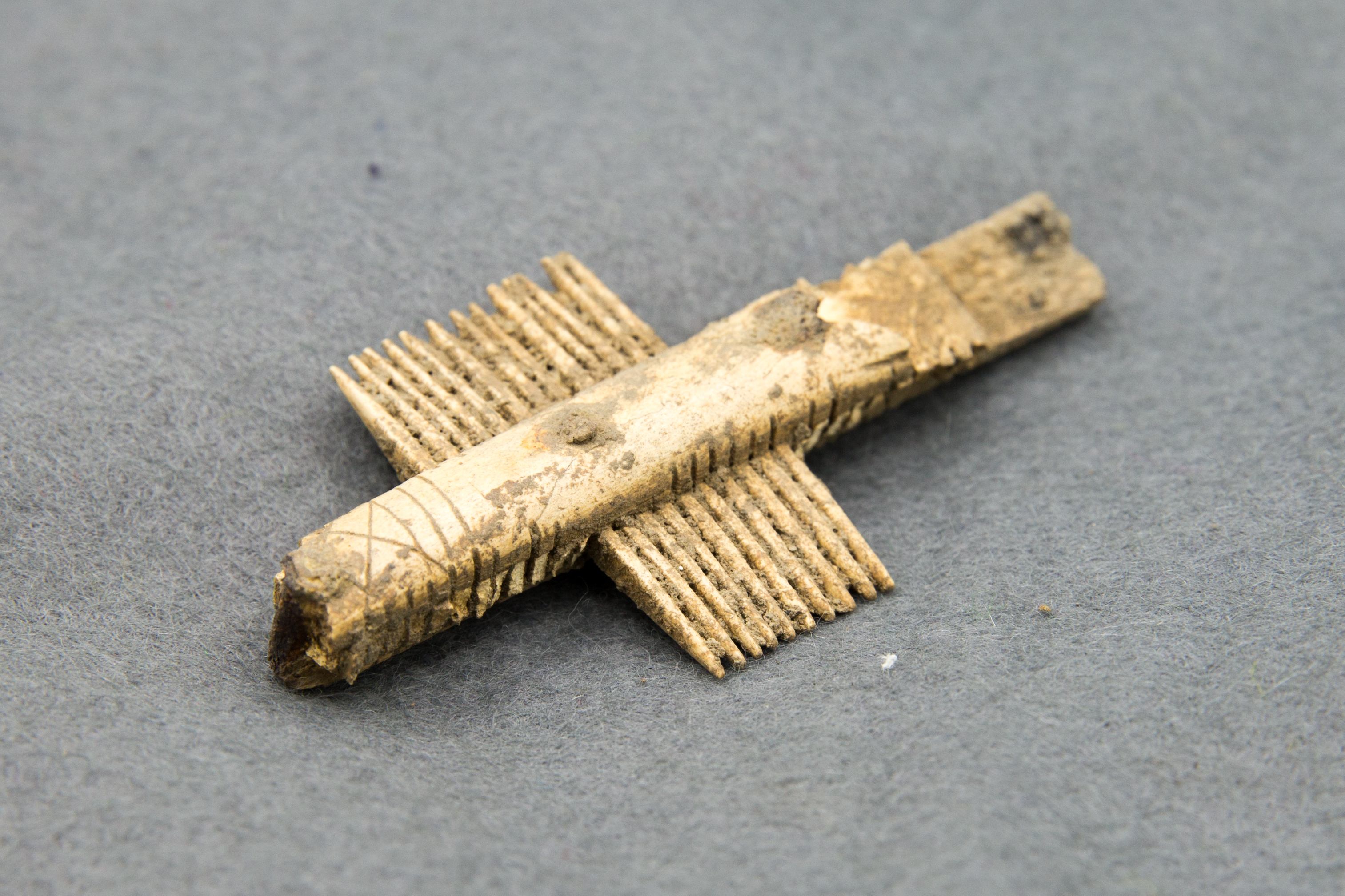
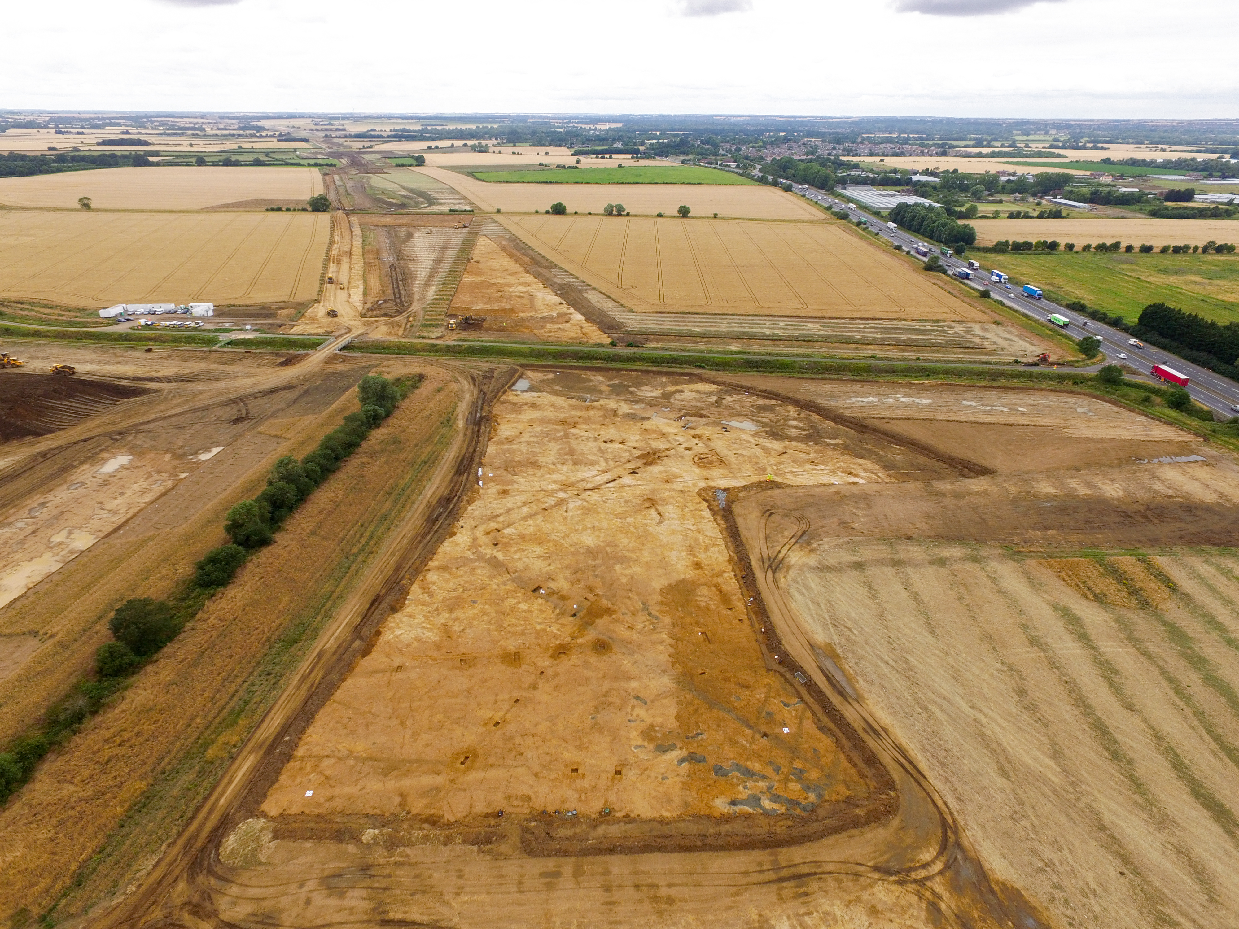
Recent excavations at Conington have uncovered a fascinating Early to Middle Saxon settlement, dating from the 6th to 9th centuries. The earliest phase revealed an open village made up of at least 24 sunken buildings, four timber structures, and many pits. Interestingly, some Roman ditches appear to have remained visible or in use during this time.
Around the 7th century, the site saw new developments, including ditches, trackways, and a small cemetery with four human burials to the east of the settlement. Later, during the Middle Saxon period, the area was reorganised with large enclosures and a new settlement to the north. One enclosure even had a gatehouse, and when it was dismantled in the late 7th to 9th century, a young woman was buried in a nearby pit—an unusual and intriguing find.
Eventually, the site was abandoned and the land returned to agricultural use, marking the end of this chapter in Conington’s history.
Find out more
Cambridgeshire Historic Environment Records
Prehistoric, Roman and Saxon settlement site, Conington
Conington deserted medieval settlement
Online project archive
A14 Cambridge to Huntingdon Improvement Scheme
A14 Road Trip to the past storymap
News
Ask the Expert: Anglo-Saxon textile making on A14C2H | MOLA
An unusual burial and a tragic story from Early Medieval Cambridgeshire | MOLA


