A14 Improvement Scheme - Board 10 Conington
Description
The A14 Cambridge to Huntingdon Improvement Scheme was led by MOLA-Headland Infrastructure (a consortium of Museum of London Archaeology and Headland Archaeology) and was funded by National Highways. These interpretation boards were installed by Cambridgeshire County Council with Oxford Archaeology East as part of a project funded by National Highways.
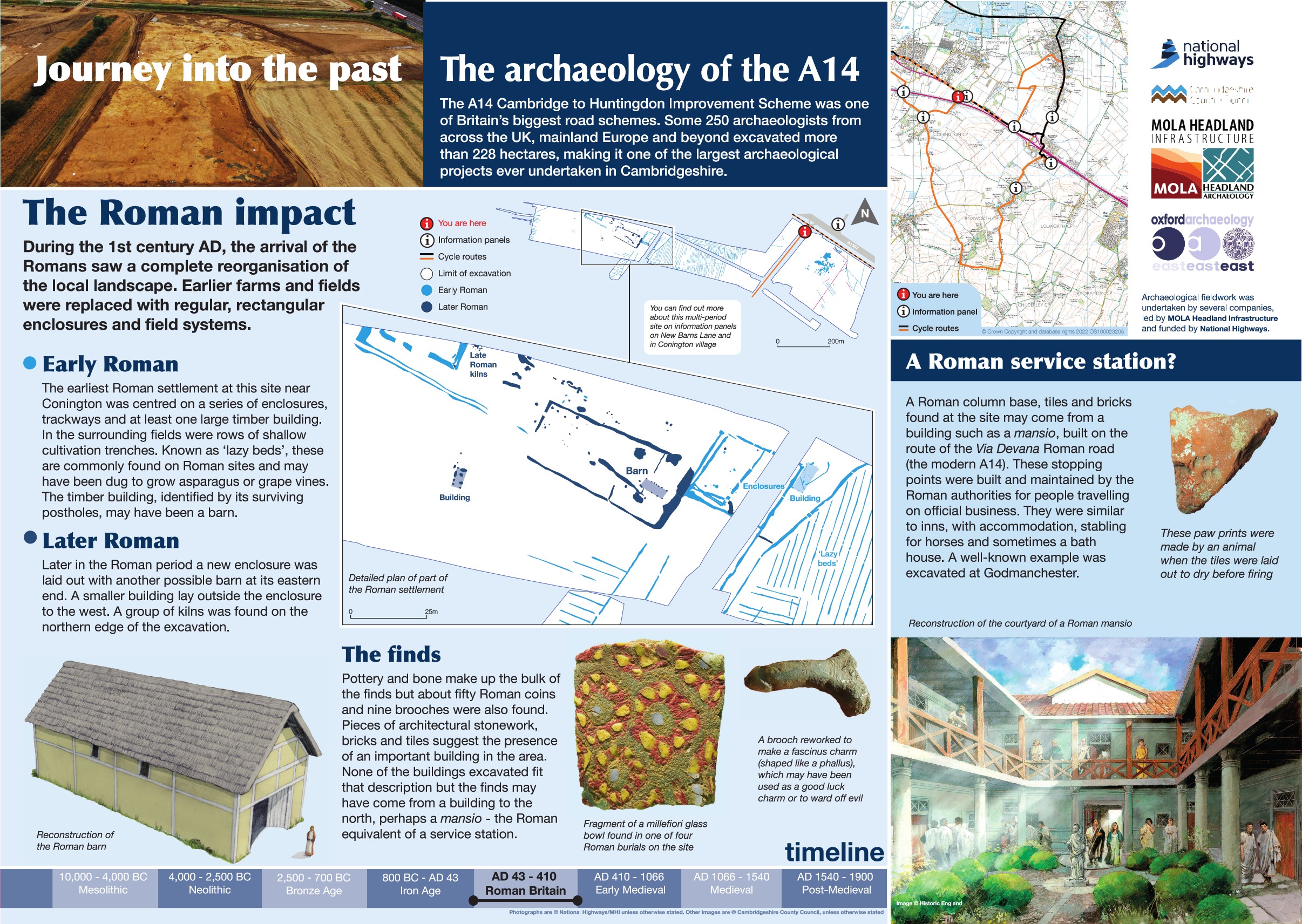
Roman discoveries across the scheme included several Roman settlement sites, at Conington features included a trackway crossing the site on an east-west alignment, several enclosures, a small Roman structure towards the eastern end, four ovens or kilns and an area of industrial residue to the north. At the eastern end a series of enclosure ditches and a large sump or watering hole was interpreted as a water management system. A second Roman structure consisted of two parallel lines of postholes on a northwest to southeast alignment was also recorded, along with extraction pits and cultivation trenches. Finally, four inhumation burials and two cremations were found.
Find out more
Cambridgeshire Historic Environment Records
Prehistoric, Roman and Saxon settlement, Conington
Bronze Age and Roman enclosures, Conington
Online project archive
A14 Cambridge to Huntingdon Improvement Scheme
A14 Road Trip to the past storymap
News


