A14 Improvement Scheme - Board 12 Fenstanton
Description
The A14 Cambridge to Huntingdon Improvement Scheme was led by MOLA-Headland Infrastructure (a consortium of Museum of London Archaeology and Headland Archaeology) and was funded by National Highways. These interpretation boards were installed by Cambridgeshire County Council with Oxford Archaeology East as part of a project funded by National Highways.
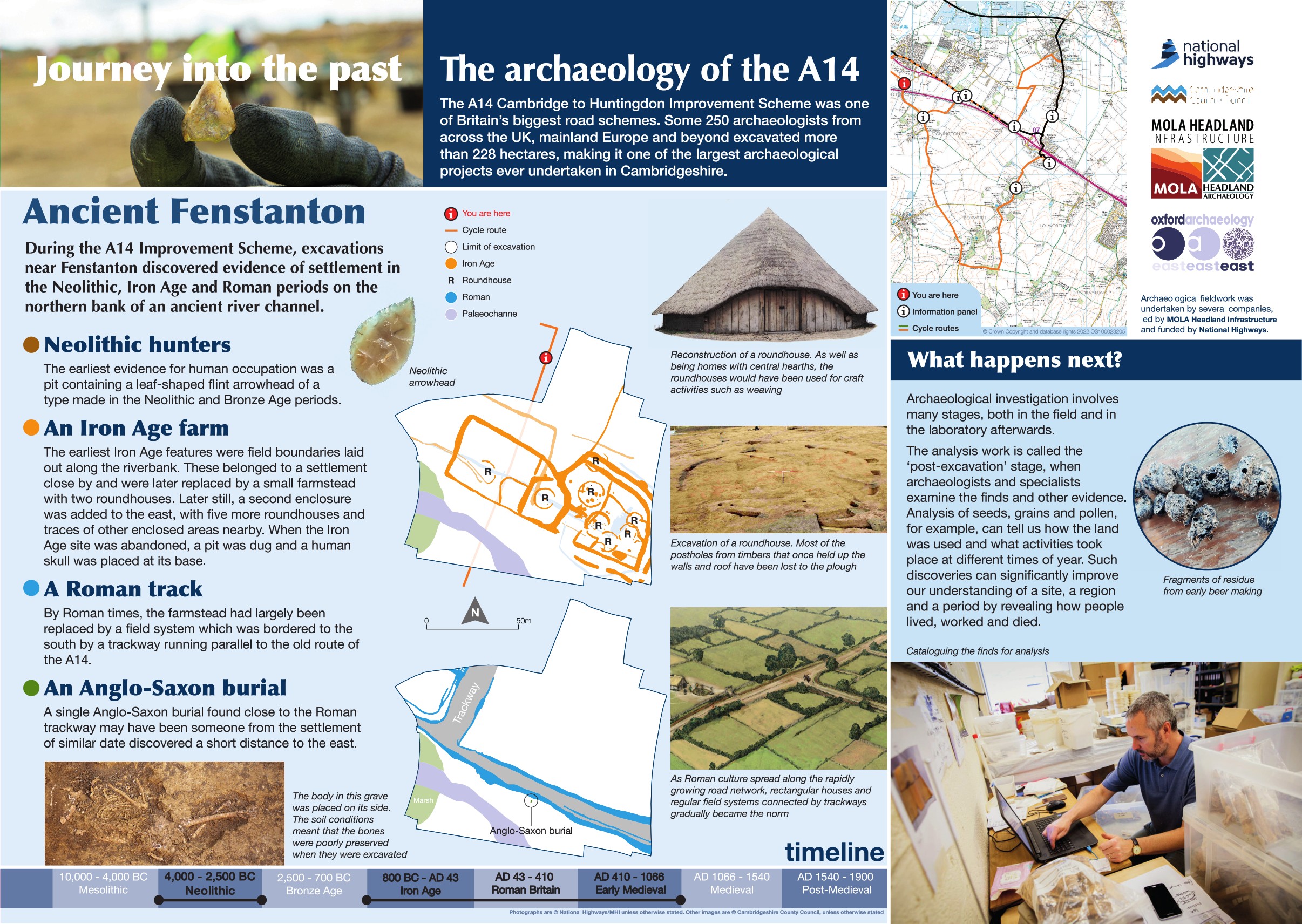
The main period of settlement here dates to the Middle to Late Iron Age. Starting life as an open settlement on the banks of a former channel, it covered an area of at least 1.5 hectares and included several ring ditches likely representing former round houses and several enclosures. Finds from the area suggest metal working and animal butchery was carried out nearby.
The settlement developed into an enclosed farmstead in the Late Iron Age with a D shaped enclosure containing several sub divisions and at least two round houses representing the main settlement and a field system to the east. This settlement continued in use throughout the Late Iron Age and into the early Roman period, with later round houses and fields added as the focus of the settlement shifted over time. A hearth was present in one round house while finds suggest domestic activity was carried out.
Investigations on the ground are only half the story with archaeological work, post excavation analysis - largely carried out in lab or digital workspace - provides extensive detail on a wide range of topics including dating, site use, the local environment and climate change over time, industry and agriculture, diet and subsistence.
Find out more
Cambridgeshire Historic Environment Records
Online project archive
A14 Cambridge to Huntingdon Improvement Scheme
A14 Road Trip to the past storymap
News
From dig to desk: the story of the A14C2H archaeology programme is just beginning | MOLA


