A14 Improvement Scheme - Board 8 Friesland Farm
Description
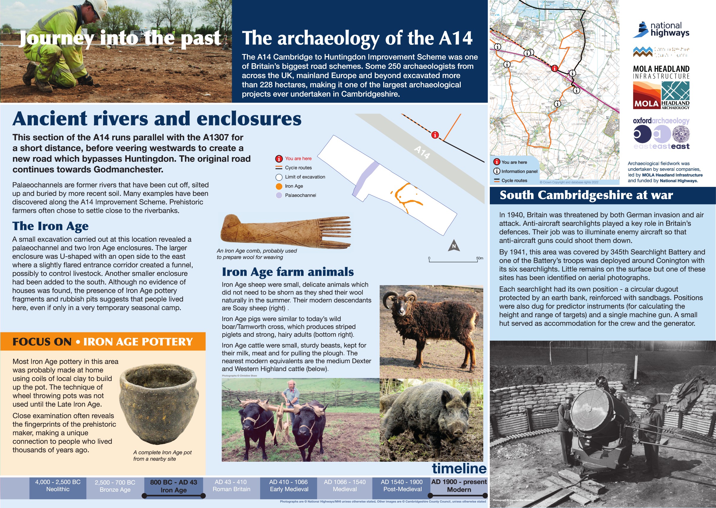
The A14 Cambridge to Huntingdon Improvement Scheme was led by MOLA-Headland Infrastructure (a consortium of Museum of London Archaeology and Headland Archaeology) and was funded by National Highways. These interpretation boards were installed by Cambridgeshire County Council with Oxford Archaeology East as part of a project funded by National Highways.
A small area was excavated at this location revealing a a buried watercourse and two Iron Age enclosures. Enclosures can represent settlement sites or agricultural activity, in this case the shape of the larger enclosure consisted of a wide circular space and a flared entrance corridor to the east creating a funnel entrance. This suggests it was designed to control livestock with the funnel entrance designed to feed them into the main space. Rubbish pits and pottery also encountered here suggest settlement was present nearby.
Find out more
Cambridgeshire Historic Environment Records
Middle Iron Age features TEA34
Former World War II searchlight battery, Friesland Farm
Online project archive
A14 Cambridge to Huntingdon Improvement Scheme
A14 Road Trip to the past storymap


