A14 Improvement Scheme - Board 7 Swavesey Roman landscape
Description
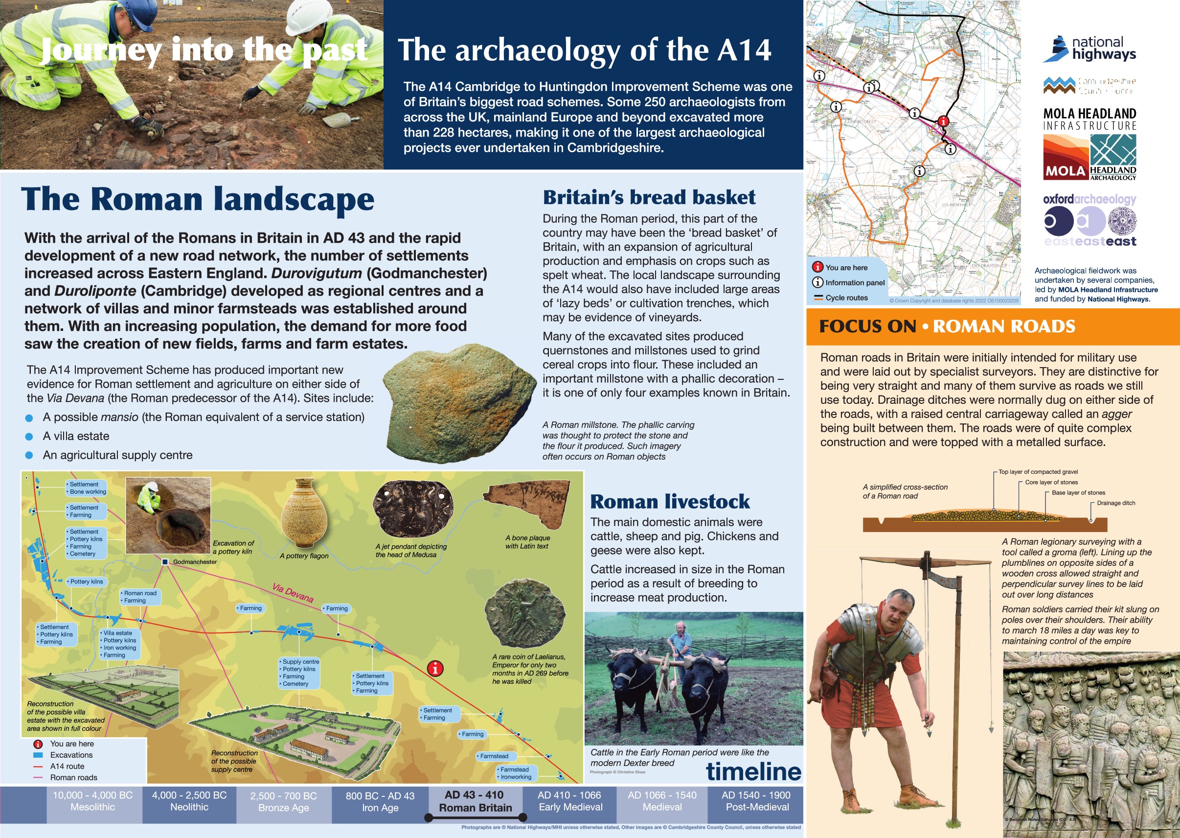
The A14 Cambridge to Huntingdon Improvement Scheme was led by MOLA-Headland Infrastructure (a consortium of Museum of London Archaeology and Headland Archaeology) and was funded by National Highways. These interpretation boards were installed by Cambridgeshire County Council with Oxford Archaeology East as part of a project funded by National Highways.
This board is located on Bucking Way Road, Swavesey and has a focus on the Roman impact on the landscape. The network of roads established during the Roman period was a major feat of engineering, initially designed for military use they remained significant connectors between towns and cities throughout the Roman period with many continuing in use into the present day.
The A14 itself was a Roman road, known as the via Devana, connecting Godmanchester with Cambridge, with this board still on the line of the original road. The location of the road has been long established, with confirmed evidence recorded at 17 locations within the county. A well preserved stretch of the road spanning nearly a mile between Worts Causeway and Hildersham Road is a Scheduled Monument.
No evidence of the major roads were encountered but trackways and smaller roads were recorded in nine locations, likely connecting smaller settlements and rural estates with the major roads.
Find out more
Cambridgeshire Historic Environment Records
Worstead Street (Via Devana) near Cambridge NHLE 1003263
Online project archive
A14 Cambridge to Huntingdon Improvement Scheme
News


