A14 Improvement Scheme - Board 6 Boxworth
Description
The A14 Cambridge to Huntingdon Improvement Scheme was led by MOLA-Headland Infrastructure (a consortium of Museum of London Archaeology and Headland Archaeology) and was funded by National Highways. These interpretation boards were installed by Cambridgeshire County Council with Oxford Archaeology East as part of a project funded by National Highways.
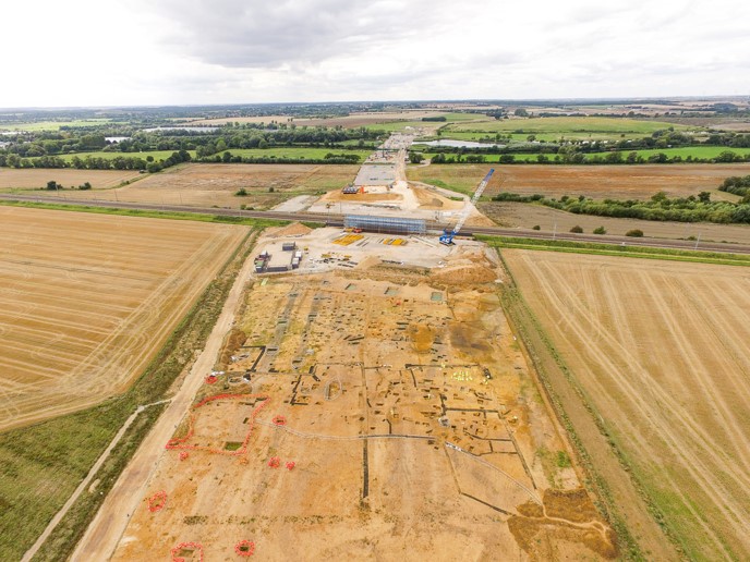
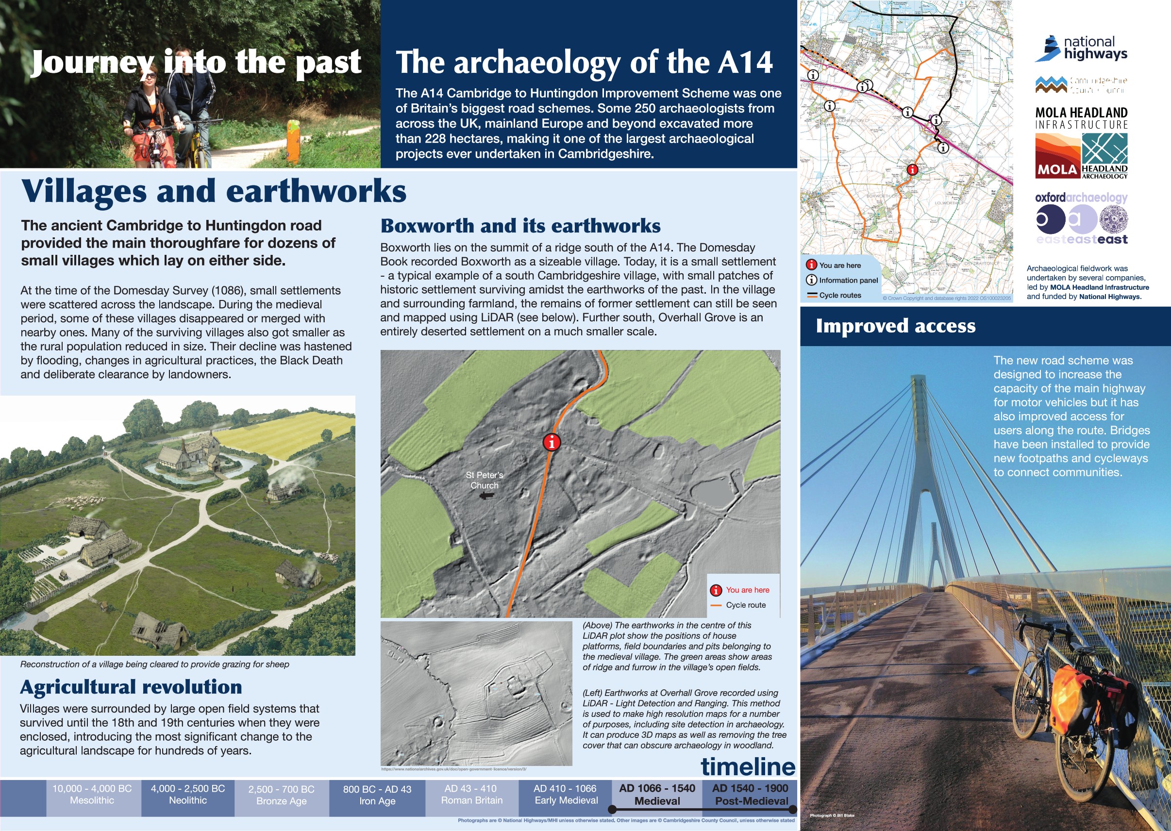
This board is located in the village of Boxworth. Although no excavation was carried out here as part of the scheme the village was affected with new non motorised routes added crossing the A14. This board looks at the wider impact of the scheme including the information it can tell us about the landscape of the A14 from the Bronze Age to modern periods.
Over 9000 environmental samples were taken during the whole scheme, providing evidence of woodland management as far back as the Neolithic and changes to the water table in the Bronze Age to Roman period leading to an increase in agricultural activity in the floodplains of the river Great Ouse and Conington landscapes. Field systems including evidence of hedgerows date as far back as the Bronze Age near Hilton while their use became commonplace in the Iron Age across the whole scheme. In the Late Saxon period, field systems established in the Conington area continued in use until the 19th century when Enclosure resulted in widescale change to the agricultural landscape.
The landscape at Boxworth represents a fairly typical medieval village with a small settlement showing evidence of ridge and furrow agricultural earthworks and former settlement earthworks. Medieval moated sites are recorded at Boxworth and further afield at Overhall Grove.
Find out more
Cambridgeshire Historic Environment Records
Boxworth shrunken medieval village
Boxworth earthwork remains of medieval ridge and furrow
High Street, Boxworth medieval moated site
Online project archive


