A14 Improvement Scheme - Board 5 Hatton Road


Description
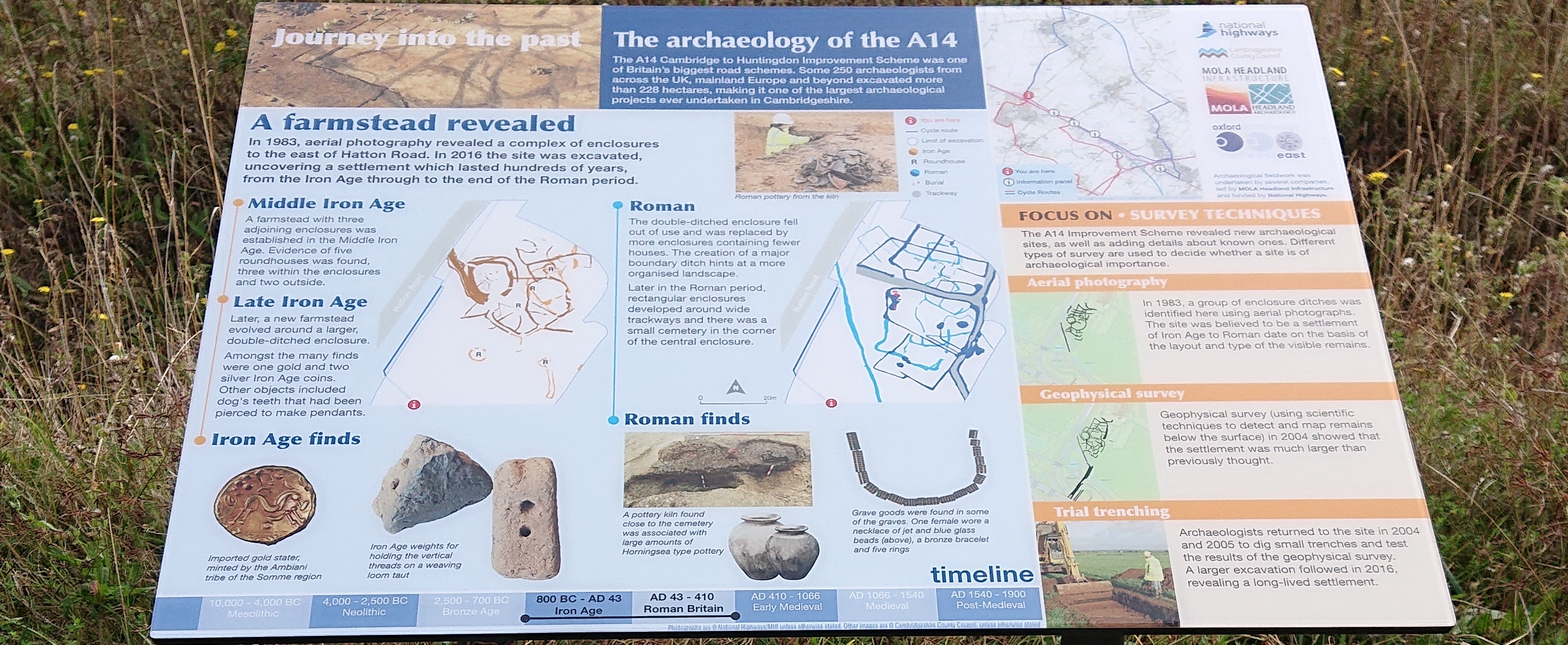
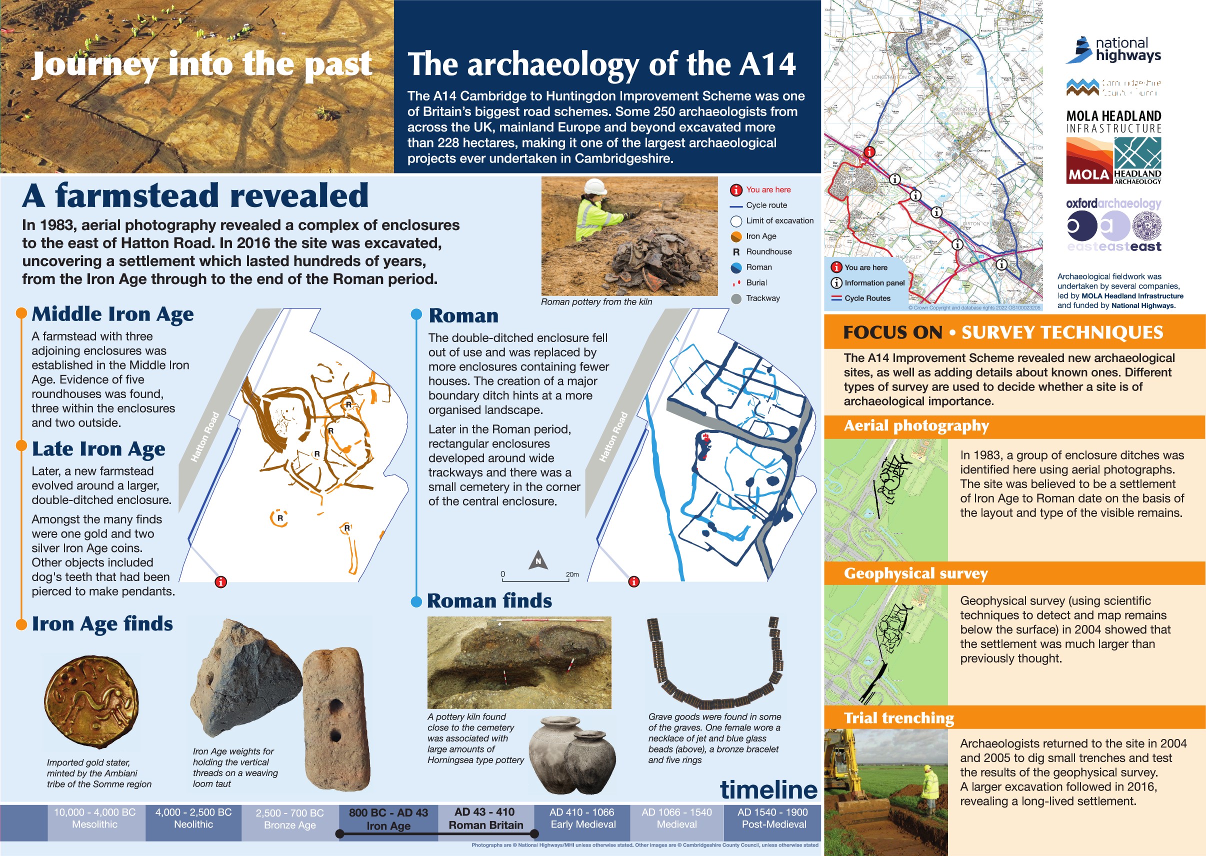
The A14 Cambridge to Huntingdon Improvement Scheme was led by MOLA-Headland Infrastructure (a consortium of Museum of London Archaeology and Headland Archaeology) and was funded by National Highways. These interpretation boards were installed by Cambridgeshire County Council with Oxford Archaeology East as part of a project funded by National Highways.
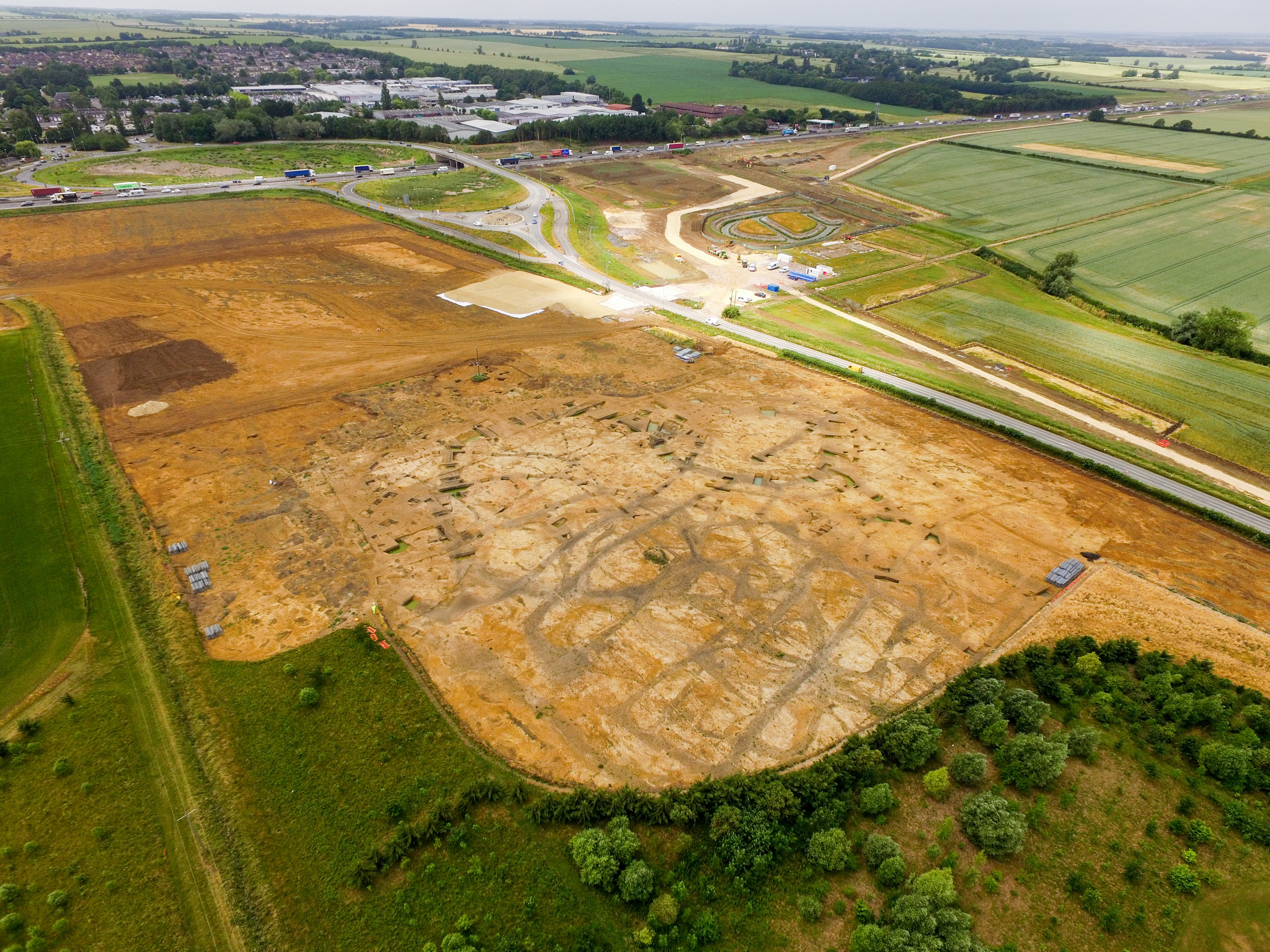
This board is located on the cycle path near Hazelwell House. Identifying where to excavate during major development schemes is a balance between addressing inevitable damage to known sites and identifying previously unrecorded sites. At Hazelwell House, a probable prehistoric site had been recorded in the HER since 1983, investigation as part of the A14 scheme included geophysical survey and evaluation, identifying more extensive remains of the site. The excavation in 2017 further added to our knowledge, confirming the presence of a small enclosed settlement dating from the Middle Iron Age to Roman period.
Evidence for domestic settlement in the form of roundhouses, grain stores and water holes were recorded. Several human burials – including infants and adults – were also recorded, with a small cemetery of nine bodies.
While this evidence contributes significantly to our knowledge of the past, sometimes it is the finds that stand out during an excavation and this area had several discoveries including the macabre remains of an Iron Age comb made from a human skull bone, the unusual collection of over 6000 frog bones and an inhumation burial of a high status female that included a necklace of blue glass and jet beads.
Find out more
Cambridgeshire Historic Environment Records
Iron Age to Roman settlement, Catch Hall
Online project archive
A14 Cambridge to Huntingdon Improvement Scheme
A14 Road Trip to the past storymap
News
Murder they croaked! Investigating a prehistoric frog mystery on the A14


