A14 Improvement Scheme - Board 4 Slate Hall Farm

Description
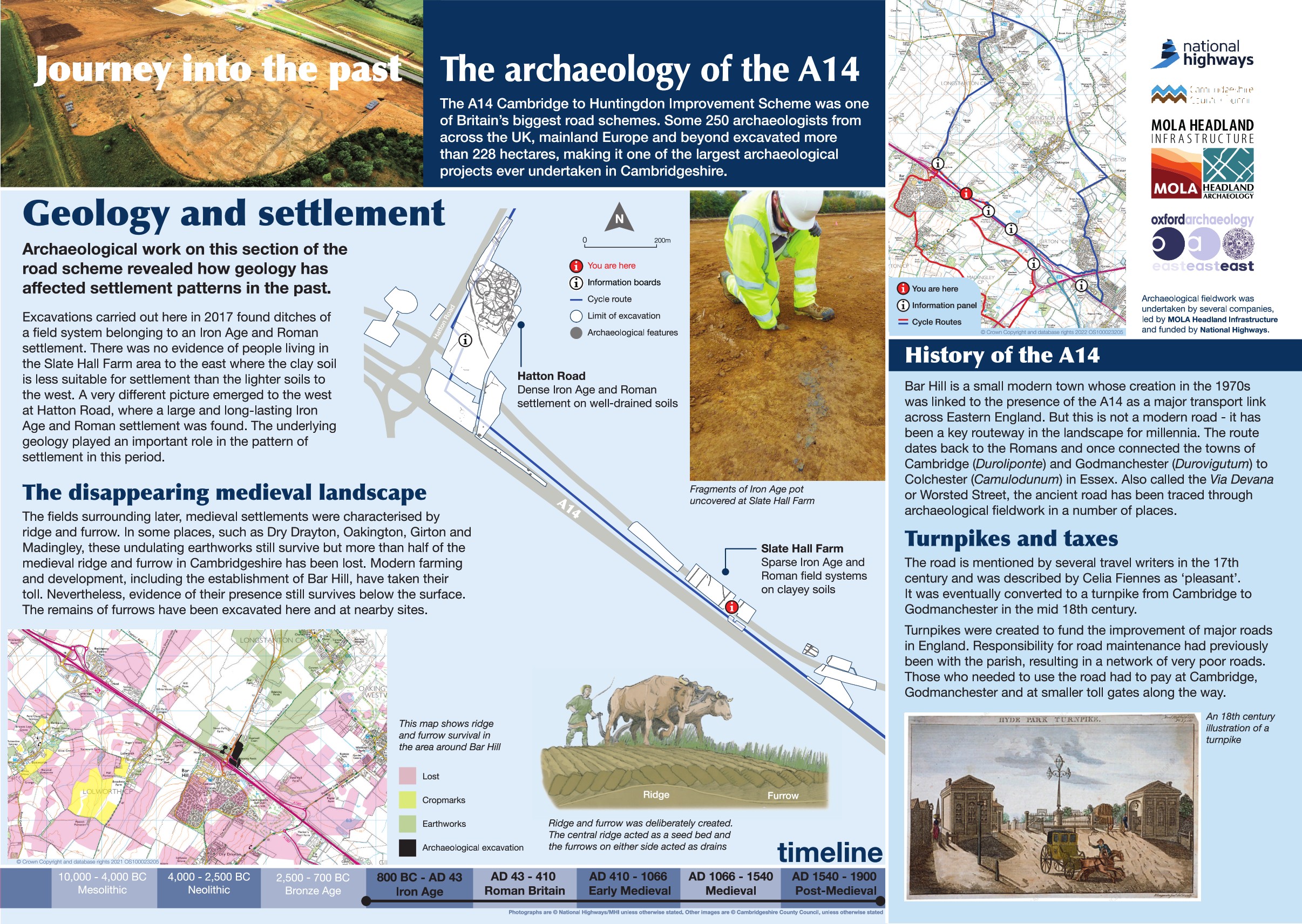
The A14 Cambridge to Huntingdon Improvement Scheme was led by MOLA-Headland Infrastructure (a consortium of Museum of London Archaeology and Headland Archaeology) and was funded by National Highways. These interpretation boards were installed by Cambridgeshire County Council with Oxford Archaeology East as part of a project funded by National Highways.
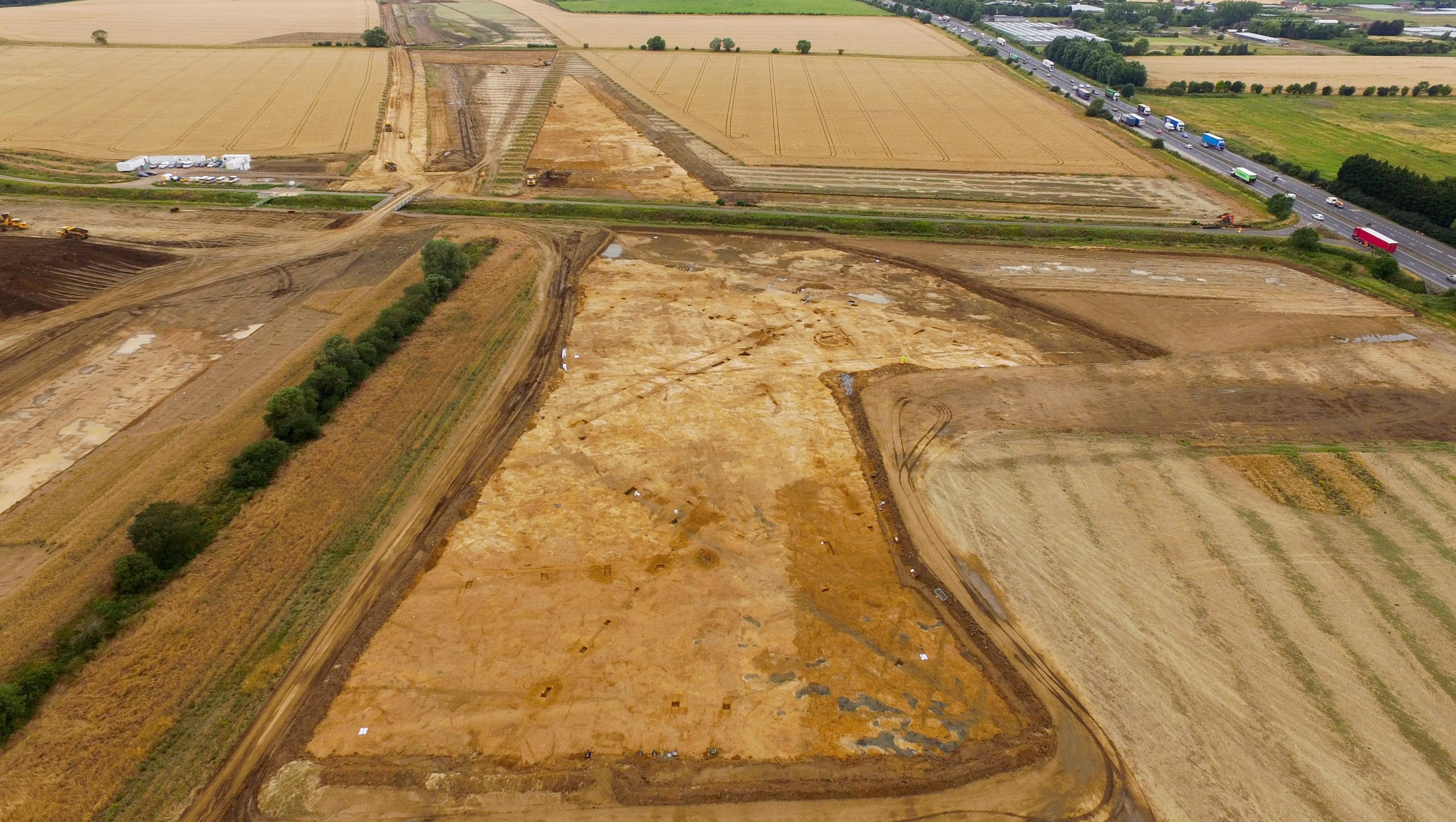
Excavations along the new cycle path near Slate Hall Farm revealed fascinating traces of past land use. The soils here are heavy clay and often waterlogged, making them less suitable for settlement. Instead, the evidence points to long-term agricultural activity.
A series of ditches uncovered show that this area was consistently used for farming from the Iron Age through the Roman period and into post-medieval times.
One feature commonly associated with medieval and later farming is ridge and furrow – the distinctive pattern created by ploughing. Today, these patterns are usually seen as earthworks in fields or as cropmarks from aerial photographs. During excavation, they appear as linear ditches and banks. Ridge and furrow was found at almost every site along the A14 project. However, in Cambridgeshire, surviving earthworks are very rare and only occur in small patches.
Find out more
Cambridgeshire Historic Environment Records
Iron Age to Roman ditches, Longstanton
Online project archive


