A14 Improvement Scheme - Board 3 Catch Hall
Description
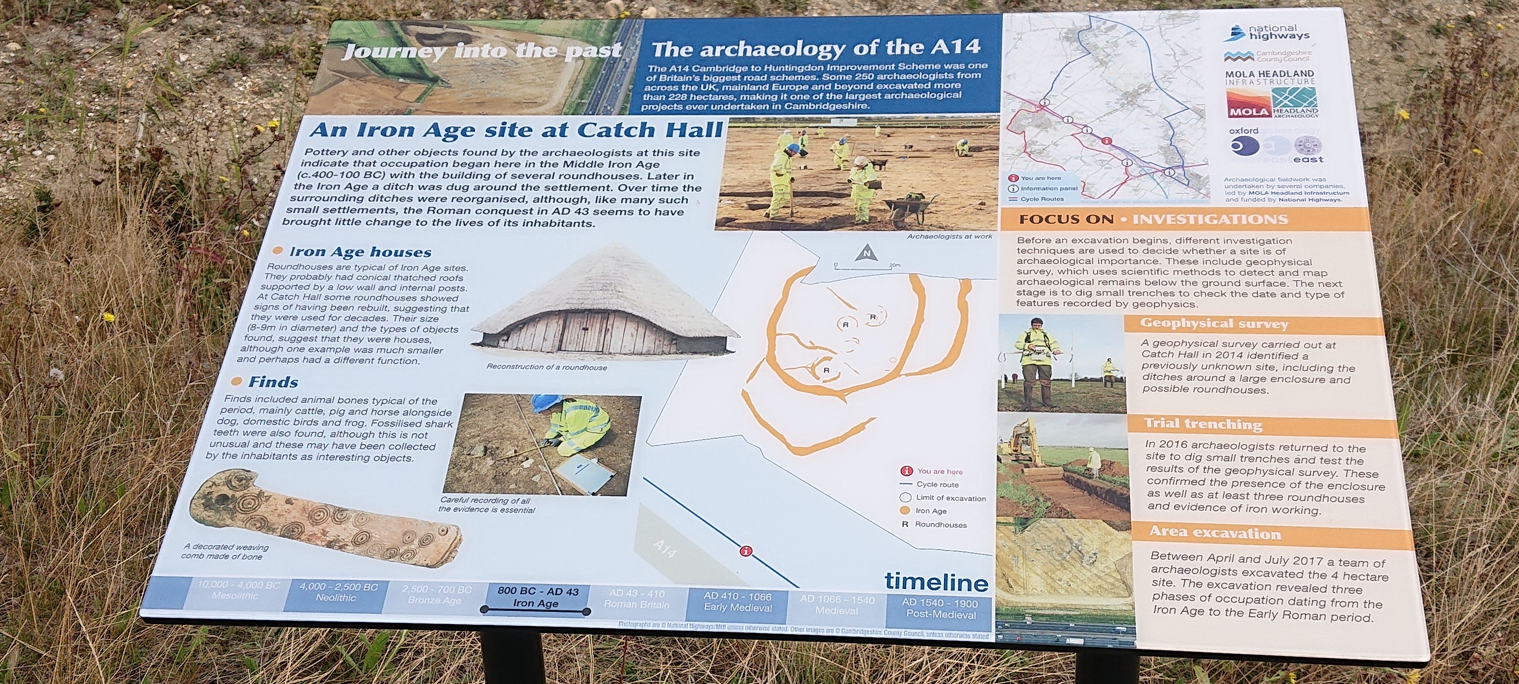
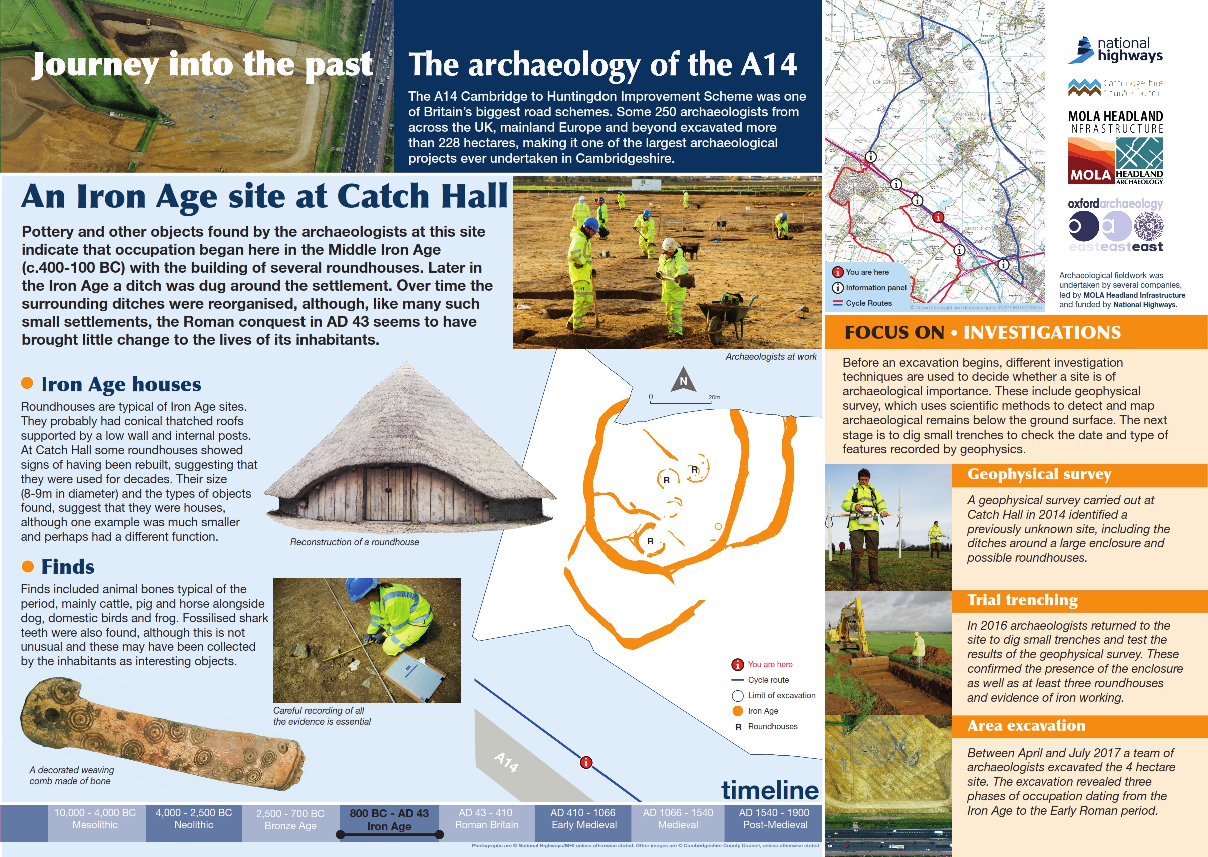
The A14 Cambridge to Huntingdon Improvement Scheme was led by MOLA-Headland Infrastructure (a consortium of Museum of London Archaeology and Headland Archaeology) and was funded by National Highways. These interpretation boards were installed by Cambridgeshire County Council with Oxford Archaeology East as part of a project funded by National Highways.
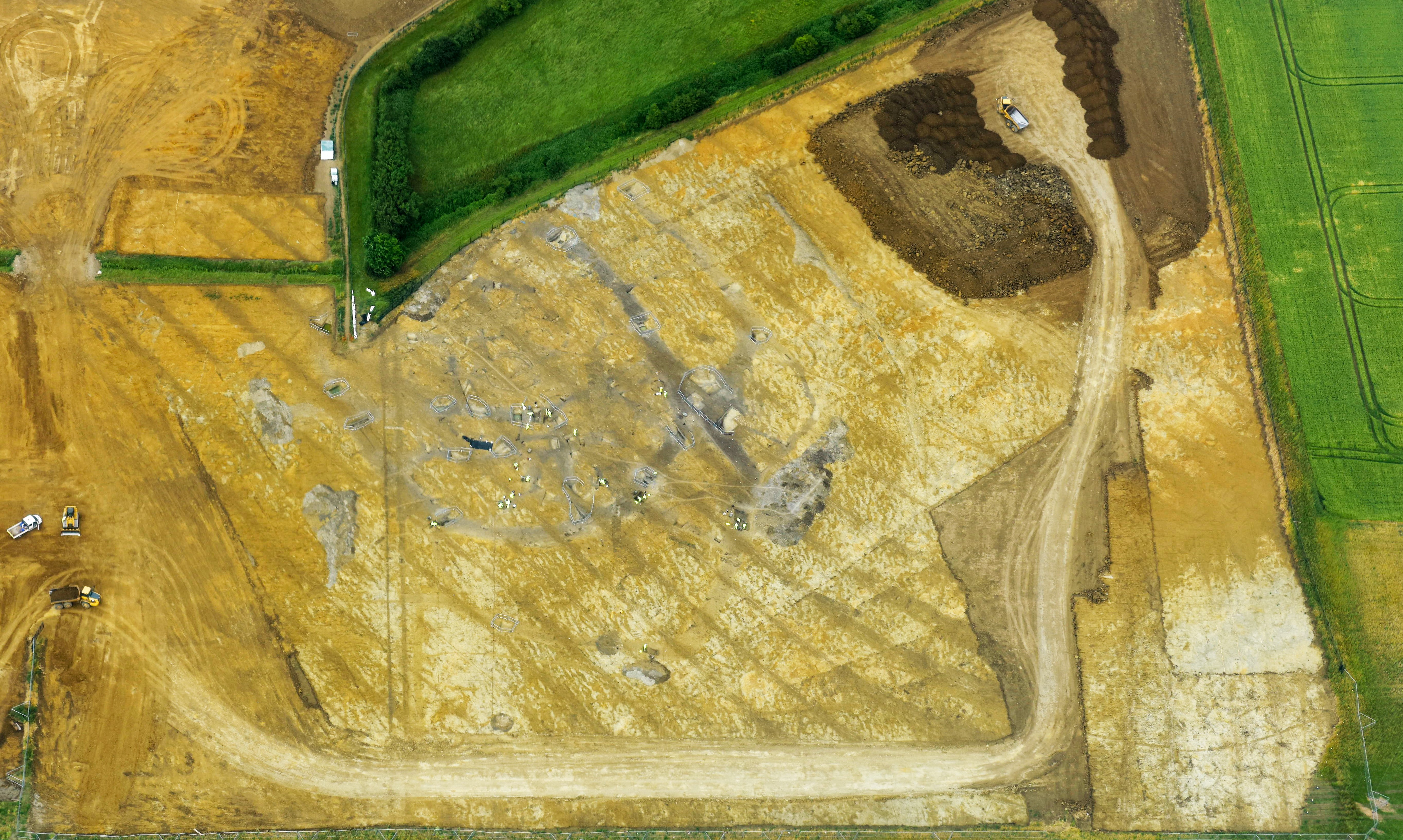
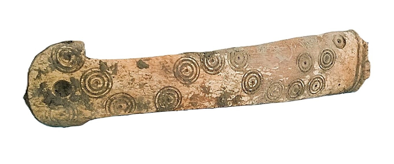
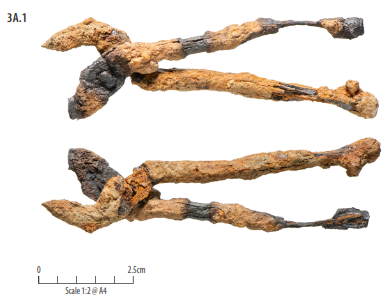
At Catch Hall, a small Middle to Late Iron Age enclosed settlement was identified. Spanning six phases of activity, the early settlement saw the establishment of an area enclosed by a boundary ditch, this site was replaced twice with larger enclosures as the settlement grew and shifted focus. Activity within this space included domestic settlement in the form of six roundhouses and a rectangular structure while finds hint at the presence of at least one kiln and a hearth. The site appeared to continue in use into the early Roman transition period with a single Roman burial recorded.
Find out more
Cambridgeshire Historic Environment Records
Iron Age to Roman settlement, Catch Hall
Online project archive
A14 Cambridge to Huntingdon Improvement Scheme
News


