A14 Improvement Scheme - Board 37 Cambridge Services monolith
Description
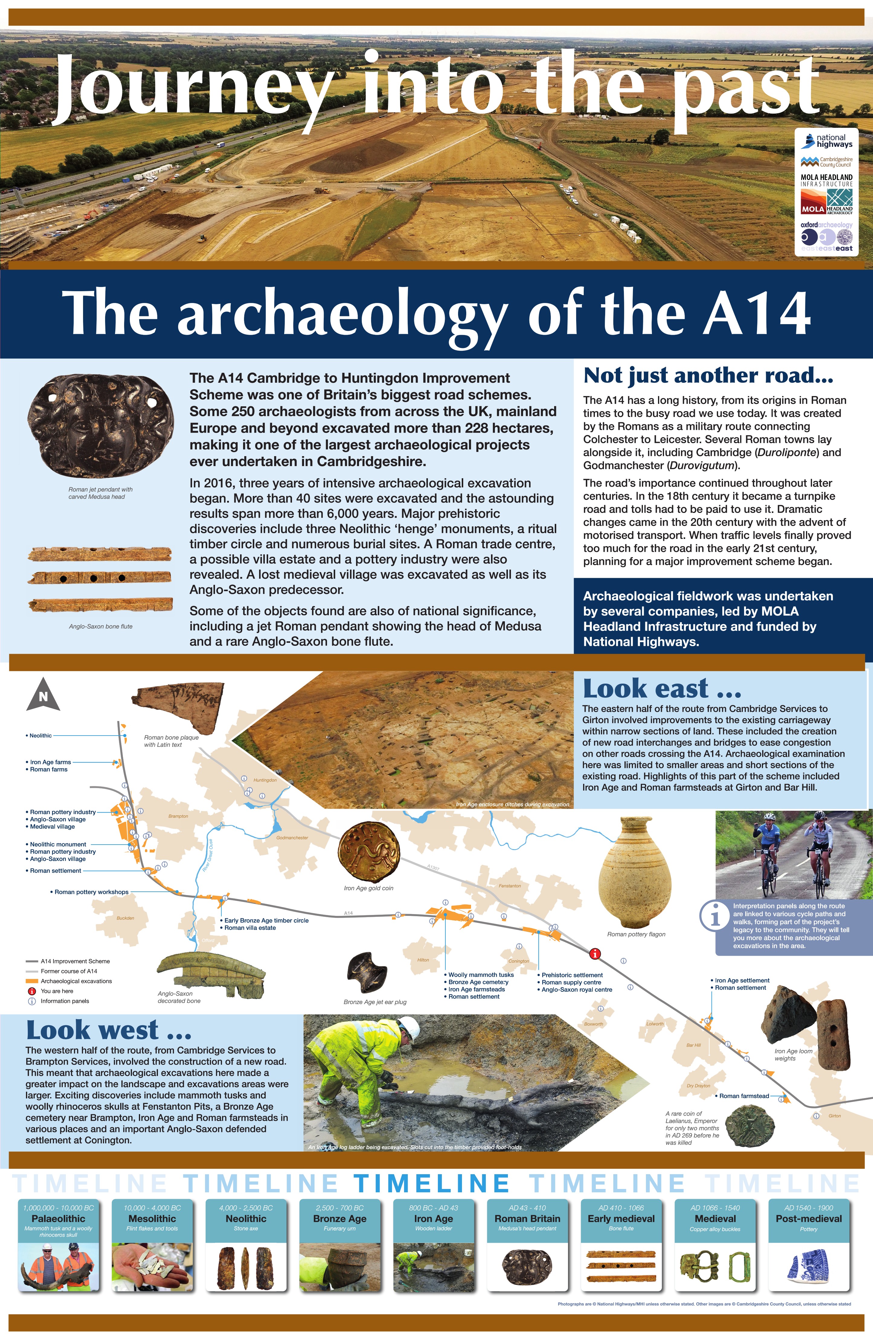
The A14 Cambridge to Huntingdon Improvement Scheme was led by MOLA-Headland Infrastructure (a consortium of Museum of London Archaeology and Headland Archaeology) and was funded by National Highways. These interpretation boards were installed by Cambridgeshire County Council with Oxford Archaeology East as part of a project funded by National Highways.
In 2016, three years of intensive archaeological excavation began. More than 40 sites were excavated and the astounding results span more than 6000 years. The western half of the scheme involved the construction of a new road. This meant that archaeological excavations here made a greater impact on the landscape and those larger areas revealed some major sites including ritual or ceremonial activity in the prehistoric period, and industry and settlement in the Roman to medieval periods.
The eastern half of the route from Cambridge Services to Girton involved improvements to the existing carriageway within narrow sections of land. These included the creation of new road interchanges and bridges to ease congestion on other roads crossing the A14. Archaeological examination here was limited to smaller areas and short sections of the existing road. Highlights of this part of the scheme included Iron Age and Roman farmsteads at Girton and Bar Hill.
The western half of the route, from Cambridge Services to Brampton Services, involved the construction of a new road. This meant that archaeological excavations here made a greater impact on the landscape and excavations areas were larger. Exciting discoveries include mammoth tusks and woolly rhinoceros skulls at Fenstanton Pits, a Bronze Age cemetery at Brampton, Iron Age and Roman farmsteads in various places and an important Anglo-Saxon defended settlement at Conington.
Find out more
Cambridgeshire Historic Environment Records
Middle Iron Age to Roman settlement, south of New Close Farm, Longstanton
Bronze Age and Roman enclosures, Conington
Online project archive
A14 Cambridge to Huntingdon Improvement Scheme
A14 Road Trip to the past storymap
News
MOLA and Headland Archaeology Form Major New Infrastructure Consortium | MOLA
Meet the people behind the UK’s largest archaeological project | MOLA
Broadening horizons on the A14C2H Community Dig: From digital pro to archaeology volunteer | MOLA


