A14 Improvement Scheme - Board 23 Lenton Lakes
Description
The A14 Cambridge to Huntingdon Improvement Scheme was led by MOLA-Headland Infrastructure (a consortium of Museum of London Archaeology and Headland Archaeology) and was funded by National Highways. These interpretation boards were installed by Cambridgeshire County Council with Oxford Archaeology East as part of a project funded by National Highways.
The natural and historic environment frequently occupy the same space with natural features forming part of the historic environment and past human activity shaping the natural environment.
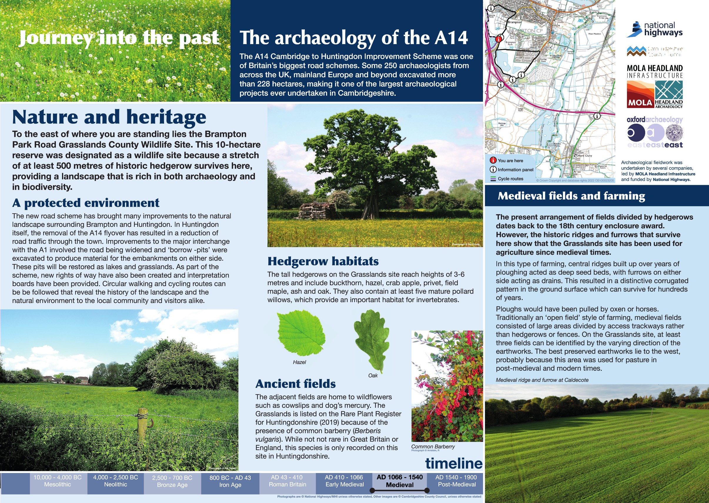
To the east lies the Brampton Park Road Grasslands County Wildlife Site. This is a 10 hectare reserve designated because it included at least 500 metres of historic hedgerow, providing a landscape that is rich in both archaeology and biodiversity. The hedgerows form part of an historic field system dating back to the 18th century while the grasslands themselves show that the area has been used for agricultural activity since the medieval period with ridge and furrow present across the whole site.
In this type of farming, a landscape of parallel linear raised earthworks are created with shallow 'bumps' and ditches between them. Preservation of this type of archaeological feature varies considerably across the country. In Cambridgeshire the preservation is low due to modern agricultural practices and unprecedented levels of development throughout the 20th century. The best preserved remains are now in Huntingdonshire where a post medieval transition to grazing reduced the impact of modern agricultural ploughing. At Brampton Park Road, the best preserved earthworks lie to the west.
Find out more
Cambridgeshire Historic Environment Records
Earthwork remains of ridge and furrow, Brampton
Online project archive
A14 Cambridge to Huntingdon Improvement Scheme
A14 Road Trip to the past storymap
Blogs
Volunteers get to grips with their local heritage on the A14C2H Summer Community Dig | MOLA


