A14 Improvement Scheme - Board 21 Brampton
Description
The A14 Cambridge to Huntingdon Improvement Scheme was led by MOLA-Headland Infrastructure (a consortium of Museum of London Archaeology and Headland Archaeology) and was funded by National Highways. These interpretation boards were installed by Cambridgeshire County Council with Oxford Archaeology East as part of a project funded by National Highways.
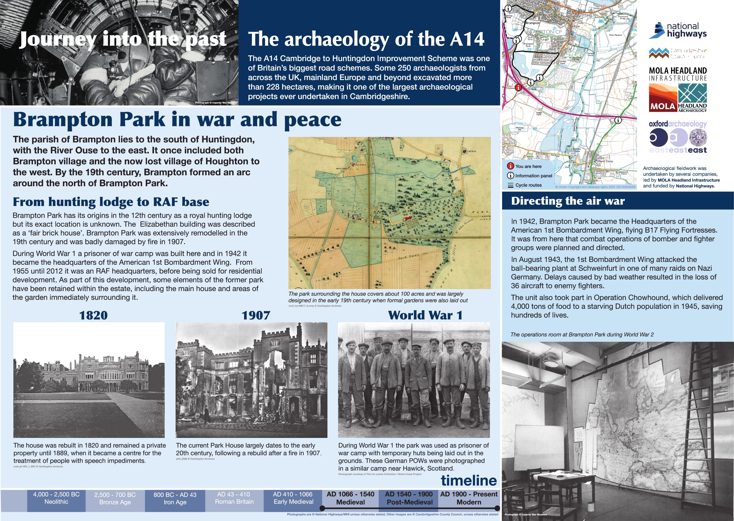
The 20th century landscape around Brampton, Huntingdon and Wyton-on-the-Hill was dominated by significant change as part of the War effort. To the northeast, Wyton was the site of a World War I and World War II airfield while RAF bases were located at Castle Hill House in Huntingdon and at Brampton Grange.
Brampton Park, started life as a medieval hunting lodge, becoming a small park in the 19th century before becoming a prisoner of war camp during World War I. In 1942 it was used as the headquarters for the American 1st Bombardment Wing, serving as a centre for combat operations of bomber and fighter groups. Post-war, the Park was handed over to the RAF who used it as a regional headquarters until it was sold in 2012.
Find out more
Cambridgeshire Historic Environment Records
Brampton Grange (RAF/US Army AF HQ)
RAF Headquarters, Castle Hill House
Online project archive


