A14 Improvement Scheme - Board 19 Station Farm Brampton
Description
The A14 Cambridge to Huntingdon Improvement Scheme was led by MOLA-Headland Infrastructure (a consortium of Museum of London Archaeology and Headland Archaeology) and was funded by National Highways. These interpretation boards were installed by Cambridgeshire County Council with Oxford Archaeology East as part of a project funded by National Highways.
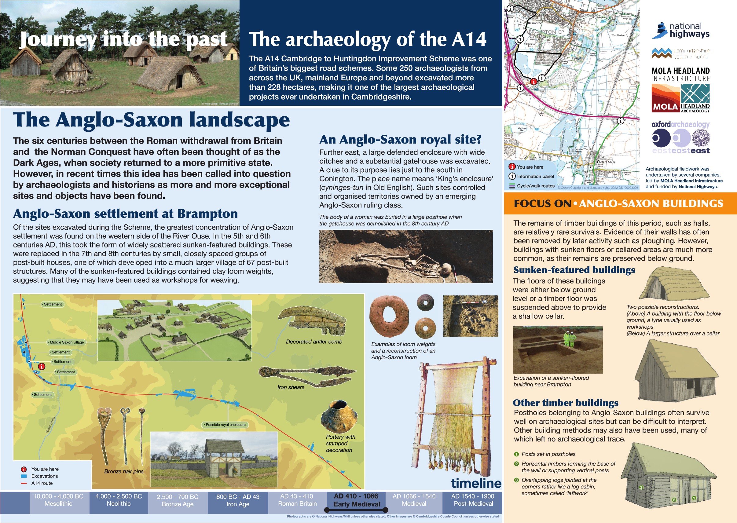
The centuries between the Roman withdrawal from Britain and the Norman Conquest have often been referred to as the Dark Ages, when society returned to a more simple state. However, in recent times this idea has been called into question by archaeologists and historians as more and more exceptional sites and objects have been found.
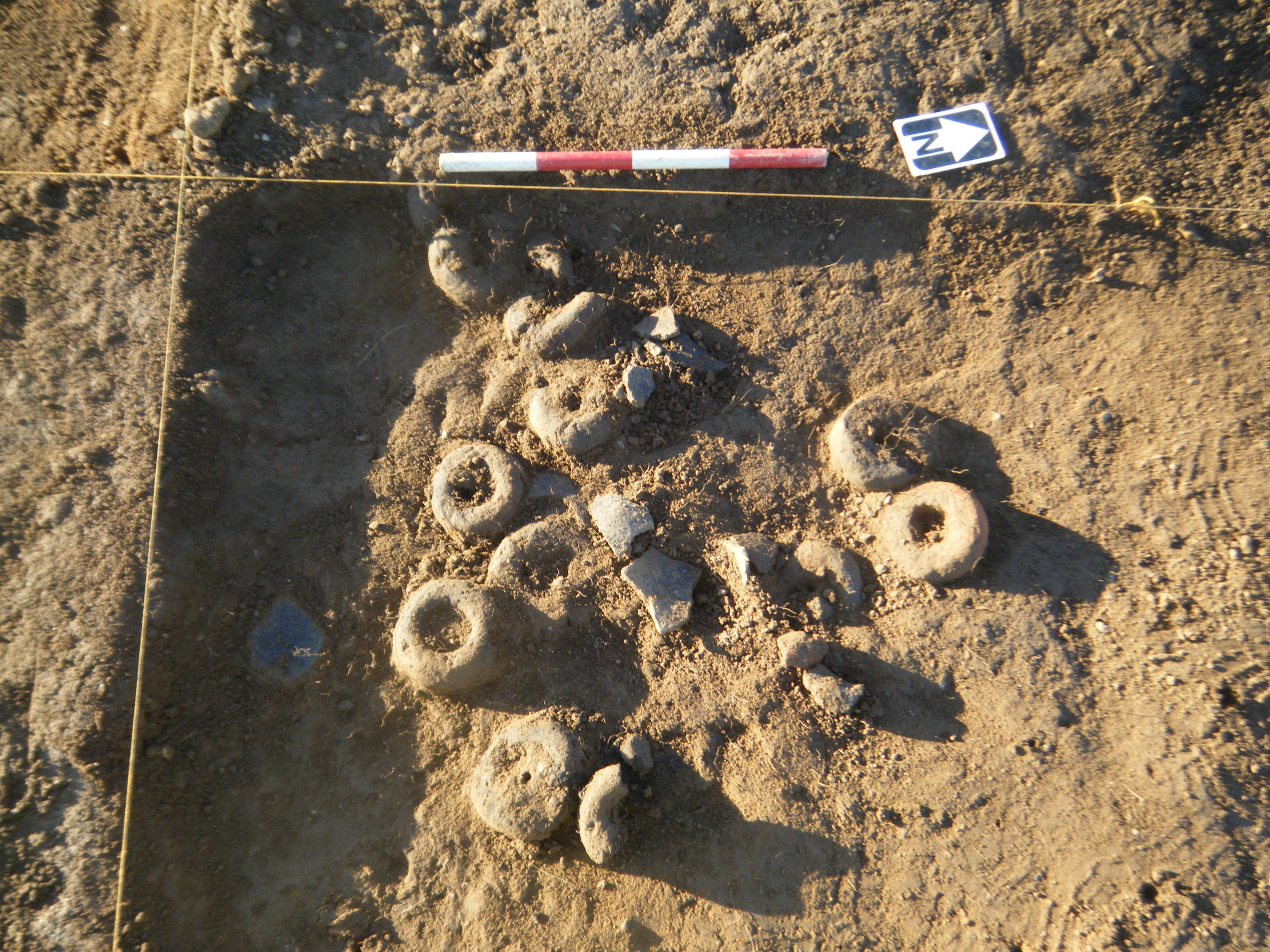
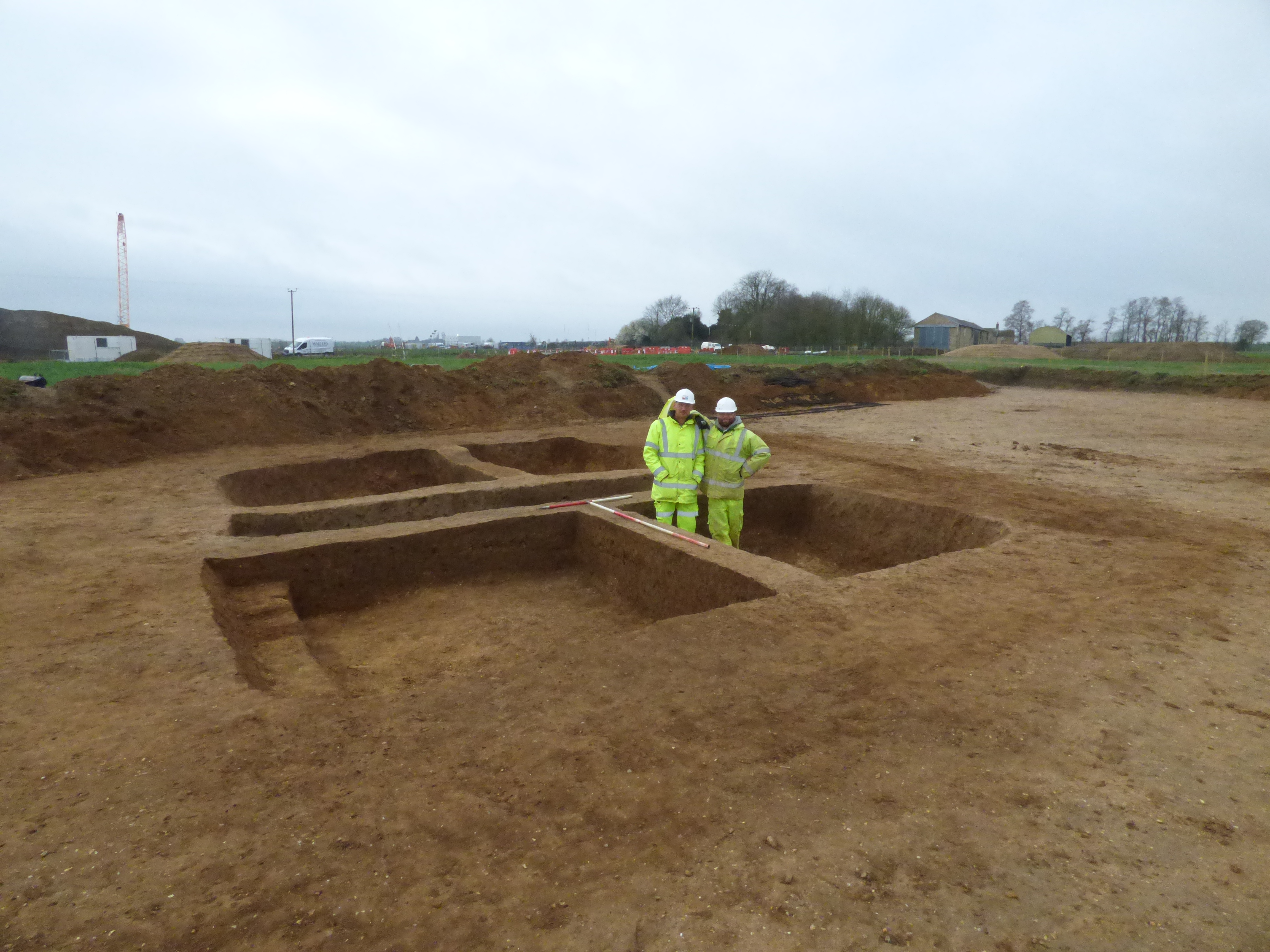
Traditionally, the Saxon period does not survive well in the archaeological record, however remains were encountered at numerous sites along the route - ranging from isolated sunken featured buildings dating to the 5th-6th centuries to small settlements consisting of post built houses in the 7th and 8th centuries, at least one of which developed into a much larger village at Brampton to the northwest of this location. To the east, at Conington, a possible Royal site dating to the 8th century was also identified.
Find out more
Cambridgeshire Historic Environment Records
Saxon settlement activity and medieval ridge and furrow, Brampton
Anglo Saxon settlement at TEA7c, Brampton Hut, Alconbury
Saxon sunken feature building, Brampton
Online project archive
A14 Cambridge to Huntingdon Improvement Scheme
A14 Road Trip to the past storymap
News
Archaeology of A14C2H from the air | MOLA
A14C2H archaeology shines light on 6,000 years of history | MOLA


