A14 Improvement Scheme - Board 20 Buckden Road Brampton
Description
The A14 Cambridge to Huntingdon Improvement Scheme was led by MOLA-Headland Infrastructure (a consortium of Museum of London Archaeology and Headland Archaeology) and was funded by National Highways. These interpretation boards were installed by Cambridgeshire County Council with Oxford Archaeology East as part of a project funded by National Highways.
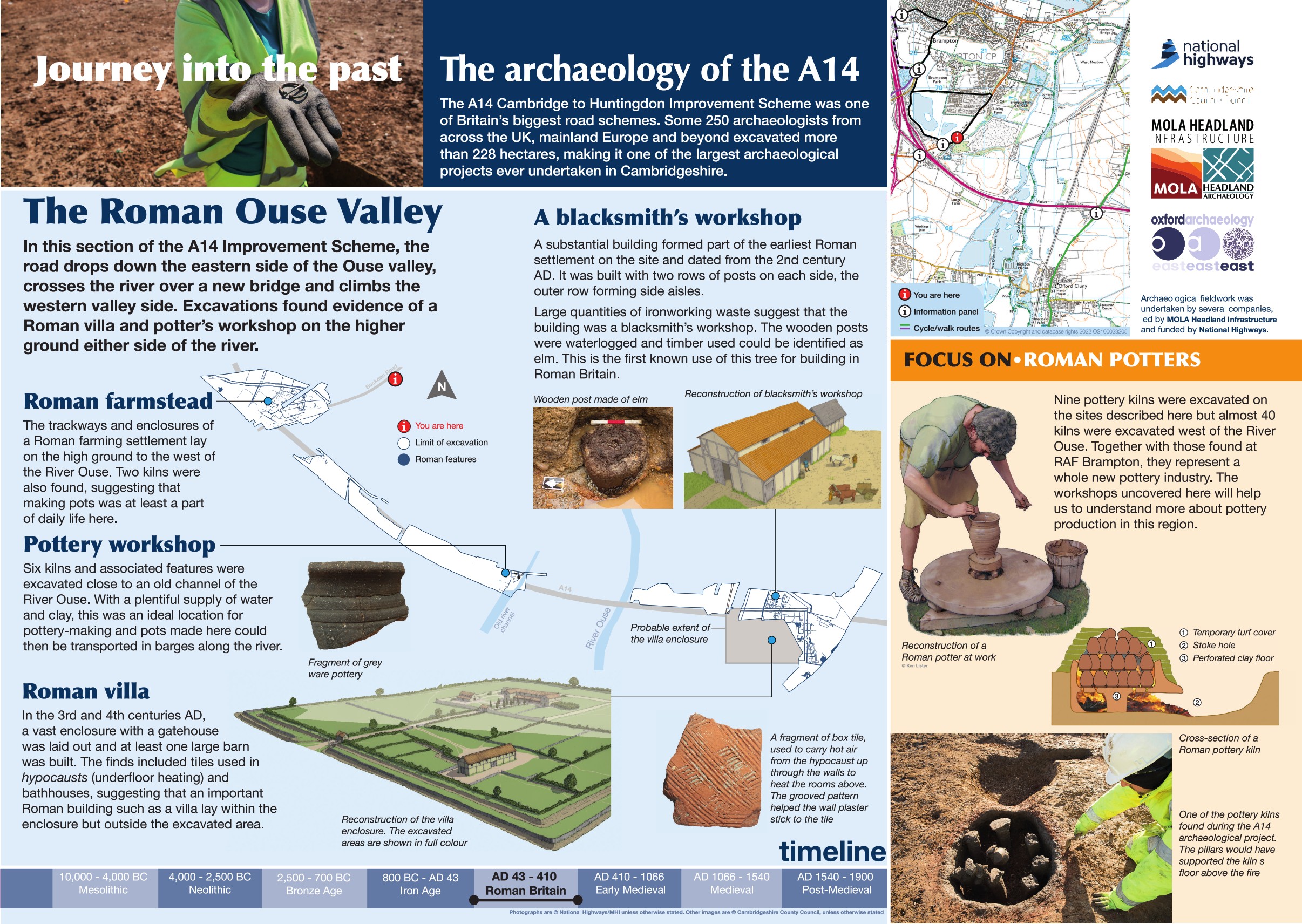
The Ouse Valley offers a fascinating window into its Roman past. From Offord Hill down to the River Great Ouse and rising again toward Brampton, the landscape was once alive with activity.
At Offord Hill, archaeologists uncovered a substantial late Roman enclosure, complete with an impressive gatehouse—hinting at a site of real significance. To the west, near Brampton, evidence of a smaller farmstead emerged, including two pottery kilns that speak to everyday rural life.
Closer to the river itself, a thriving pottery industry once operated, with six kilns recorded along its banks. These discoveries reveal a valley that was not only a hub of settlement but also a centre of craft and trade during the Roman period.
Find out more
Cambridgeshire Historic Environment Records
Middle Iron Age to Roman settlement and kilns, Offord Cluny
Roman enclosures, TEA 16, Buckden
Iron Age settlement activity and Roman pottery kilns, Brampton
Online project archive
A14 Cambridge to Huntingdon Improvement Scheme
A14 Road Trip to the past storymap
News
The many lives of objects found along the A14C2H | MOLA
‘What have the Romans ever done for us?’: the Roman Ceramic Revolution in Cambridgeshire | MOLA


