A14 Improvement Scheme - Board 22 Lenton Lakes
Description
The A14 Cambridge to Huntingdon Improvement Scheme was led by MOLA-Headland Infrastructure (a consortium of Museum of London Archaeology and Headland Archaeology) and was funded by National Highways. These interpretation boards were installed by Cambridgeshire County Council with Oxford Archaeology East as part of a project funded by National Highways.
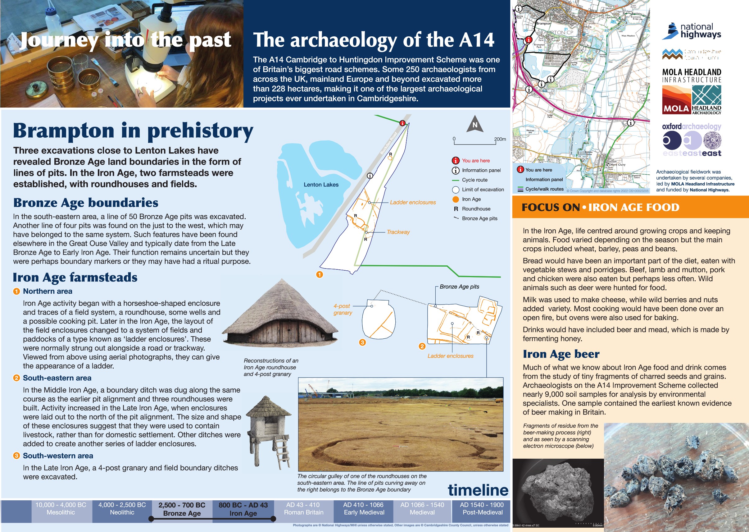
Recent excavations near Lenton Lakes have uncovered fascinating evidence of life and land use during the Bronze Age and Iron Age.
In the southeastern area, archaeologists revealed a striking line of 50 pits, with traces of a second line to the west. While their exact purpose remains uncertain, these features may have marked land divisions or held ritual significance.
Evidence of Iron Age activity was found across three areas:
-
Northern Area
Early activity included a horseshoe-shaped enclosure, a field system, a roundhouse, wells, and a possible cooking pit. By the later Iron Age, the original fields were reorganized into a distinctive “ladder enclosure” system—fields arranged along a trackway that, from above, resemble the rungs of a ladder. -
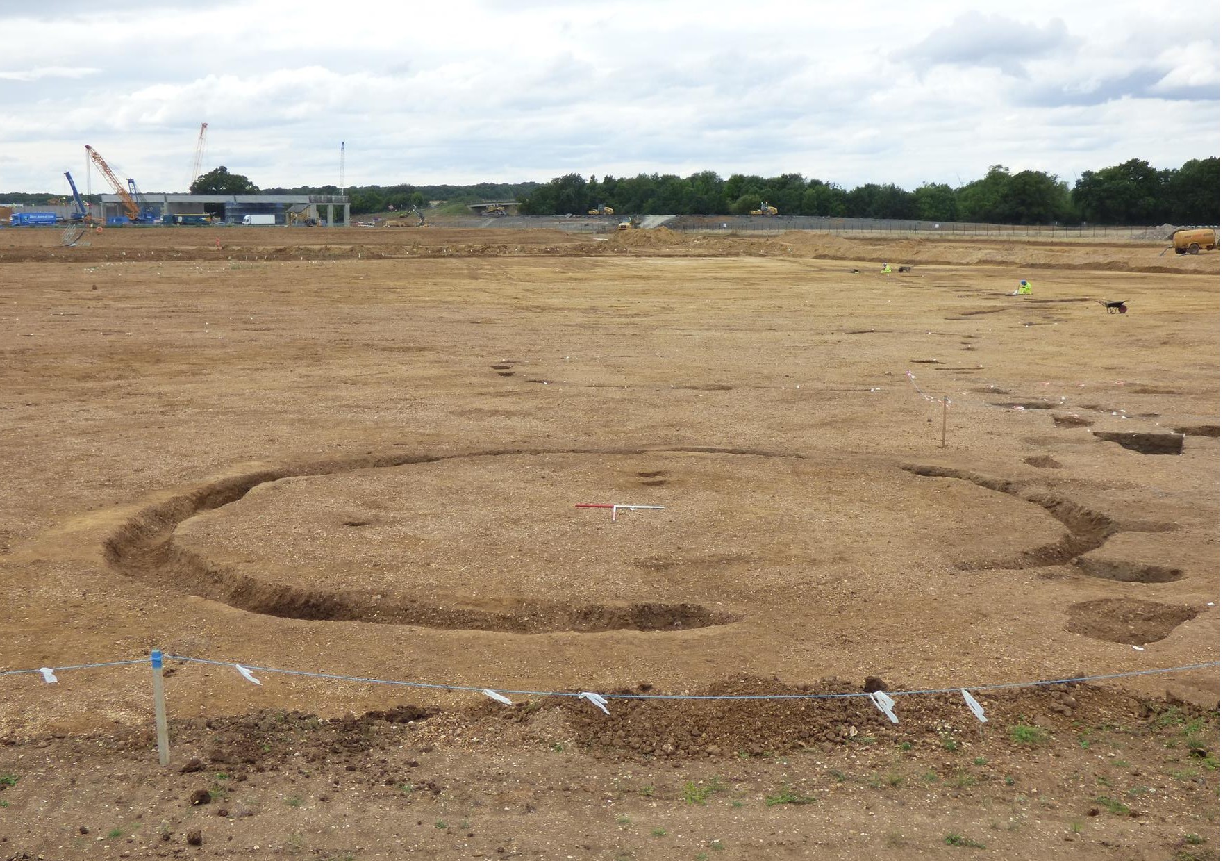
Southern Area
To the west, archaeologists recorded a Late Iron Age granary and field boundaries. To the east, three roundhouses and a boundary ditch dating to the Middle Iron Age were discovered. Activity intensified during the Late Iron Age, with new enclosures likely used as animal pens.
Find out more
Cambridgeshire Historic Environment Records
Prehistoric pit alignment and Iron Age settlement west of Throckmorton Road, Brampton
Iron Age horseshoe enclosures 280m east of Grafham Road Cottages, Brampton
Online project archive
A14 Cambridge to Huntingdon Improvement Scheme
A14 Road Trip to the past storymap
News
Our favourite finds so far: A14 Cambridge to Huntingdon | MOLA


