A14 Improvement Scheme - Board 18 Offord Cluny
Description
The A14 Cambridge to Huntingdon Improvement Scheme was led by MOLA-Headland Infrastructure (a consortium of Museum of London Archaeology and Headland Archaeology) and was funded by National Highways. These interpretation boards were installed by Cambridgeshire County Council with Oxford Archaeology East as part of a project funded by National Highways.
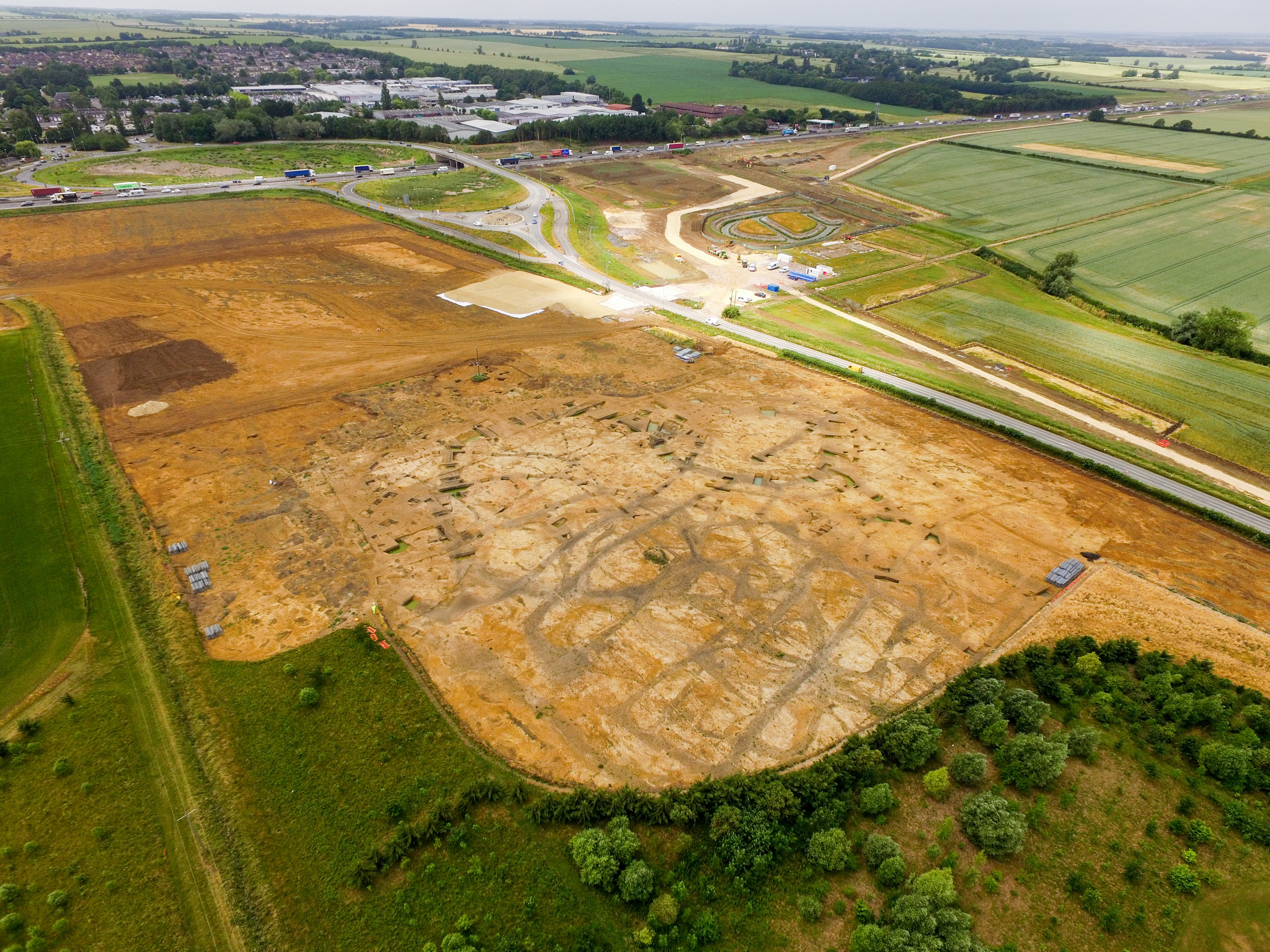
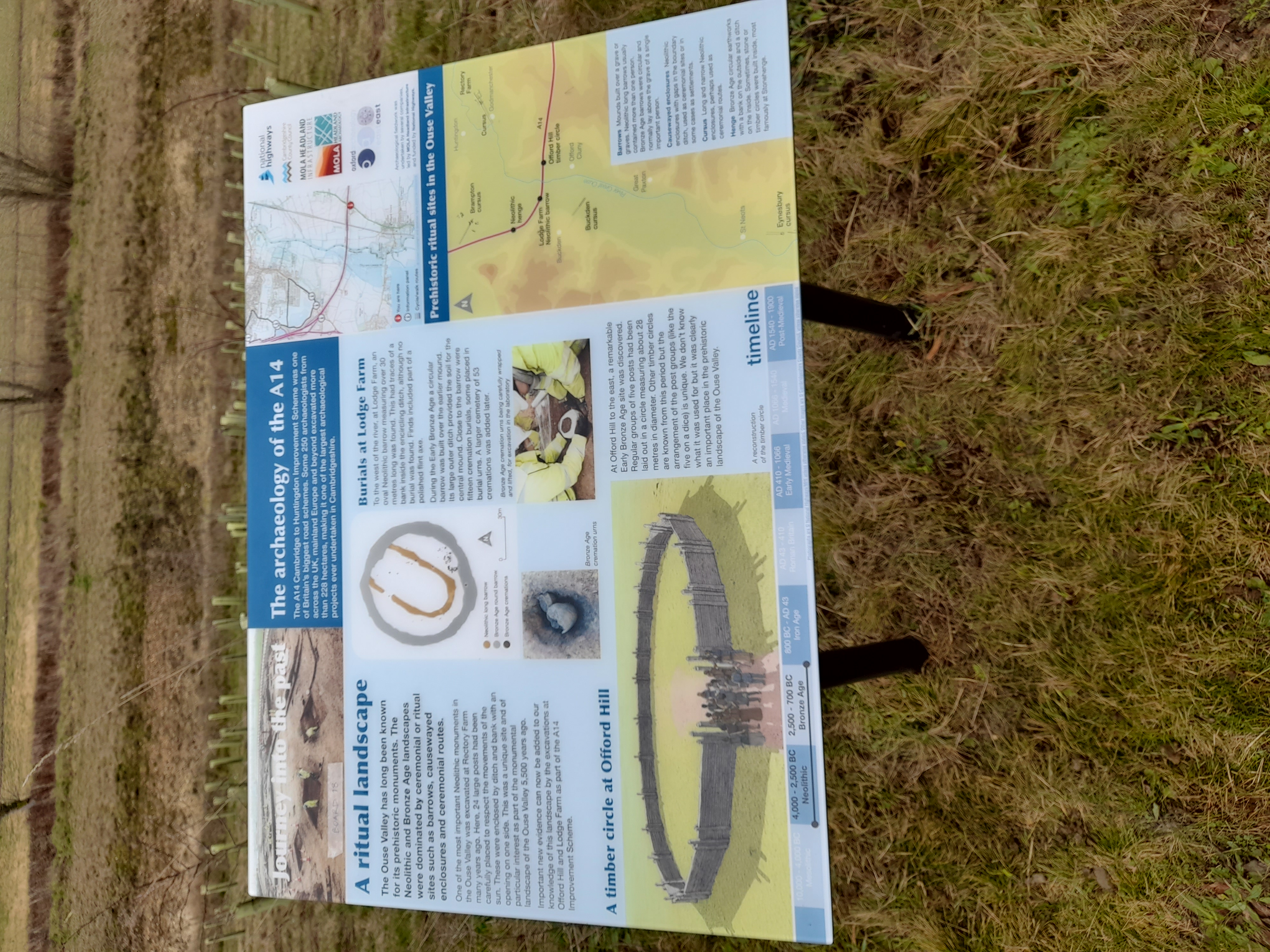
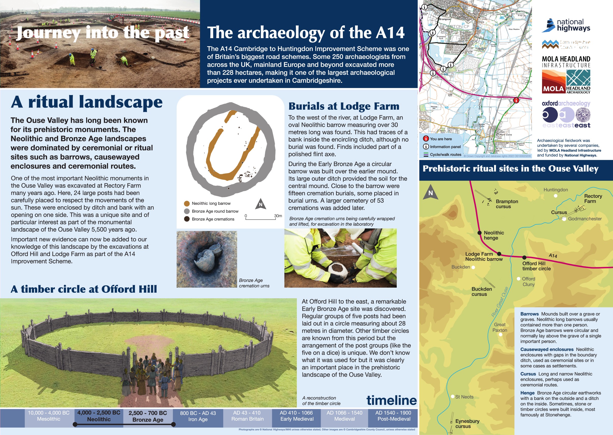
The Neolithic and Bronze Age landscapes were dominated by ceremonial and ritual sites such as barrows, causewayed enclosures and ceremonial routes. The Ouse Valley has long been known for its prehistoric monuments such as a Neolithic cursus to the northeast at Rectory Farm, Godmanchester while to the west Neolithic features and a Middle Bronze Age cremation cemetery were identified at Buckden.
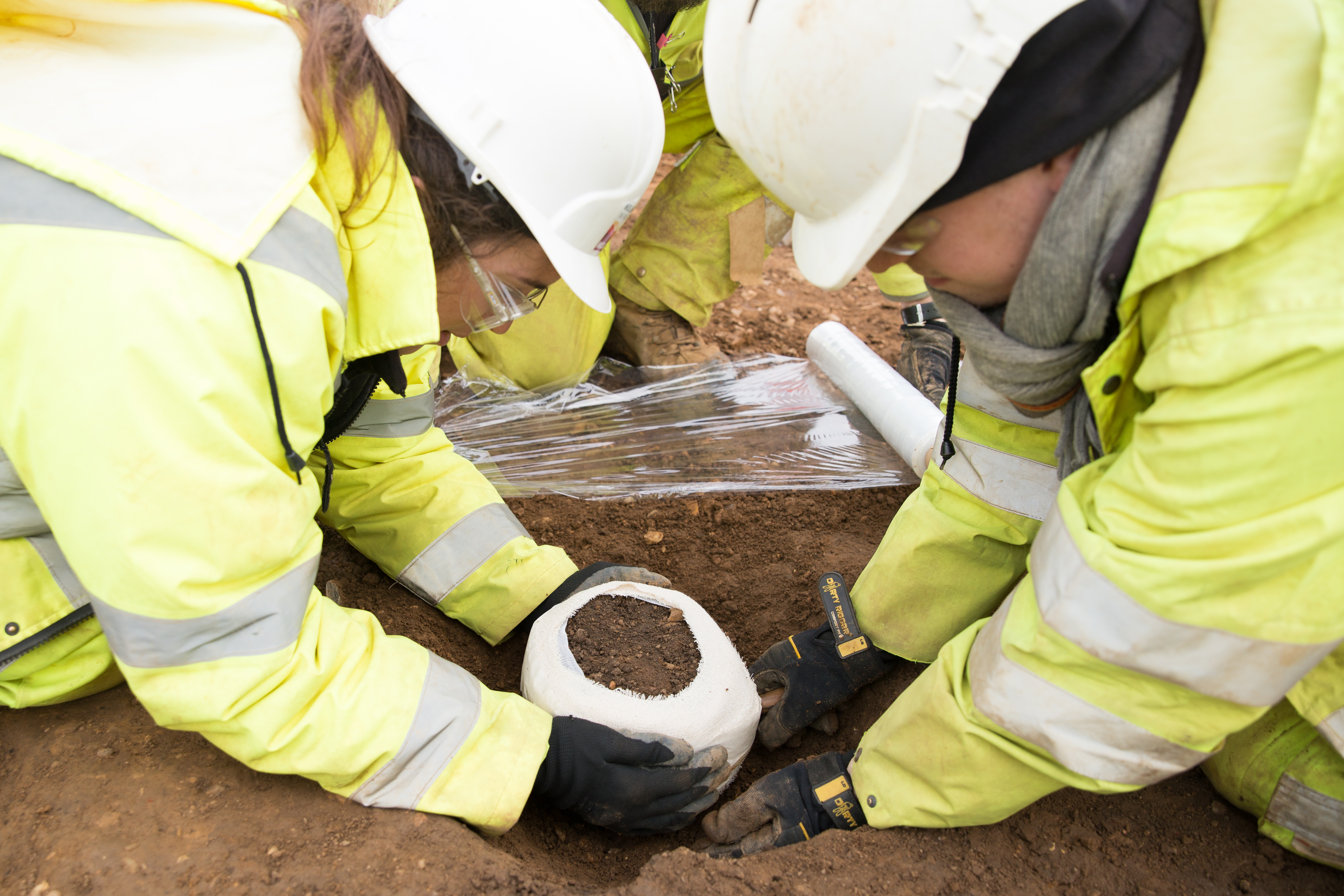
The A14 Improvement Scheme has recorded prehistoric ritual landscapes at several sites, at Offord Hill a remarkable Early Bronze Age site consisting of a circular feature comprising regular groups of 5 posts and measuring 28 metres in diameter was discovered while further to the west at Lodge Farm a Neolithic oval barrow with later reuse in the Bronze Age was recorded.
Find out more
Cambridgeshire Historic Environment Records
Neolithic monument complex, Rectory Farm, Godmanchester
Middle Iron Age to Roman settlement and kilns, Offord Cluny
Early Bronze Age barrow and associated features, Buckden
Online project archive
A14 Cambridge to Huntingdon Improvement Scheme
A14 Road Trip to the past storymap
News
What can stone tools tell us about prehistoric lives on the A14? | MOLA
A potted history of Cambridgeshire: Ceramic finds from the A14C2H | MOLA


