A14 Improvement Scheme - Board 17 Hemingfords
Description
The A14 Cambridge to Huntingdon Improvement Scheme was led by MOLA-Headland Infrastructure (a consortium of Museum of London Archaeology and Headland Archaeology) and was funded by National Highways. These interpretation boards were installed by Cambridgeshire County Council with Oxford Archaeology East as part of a project funded by National Highways.
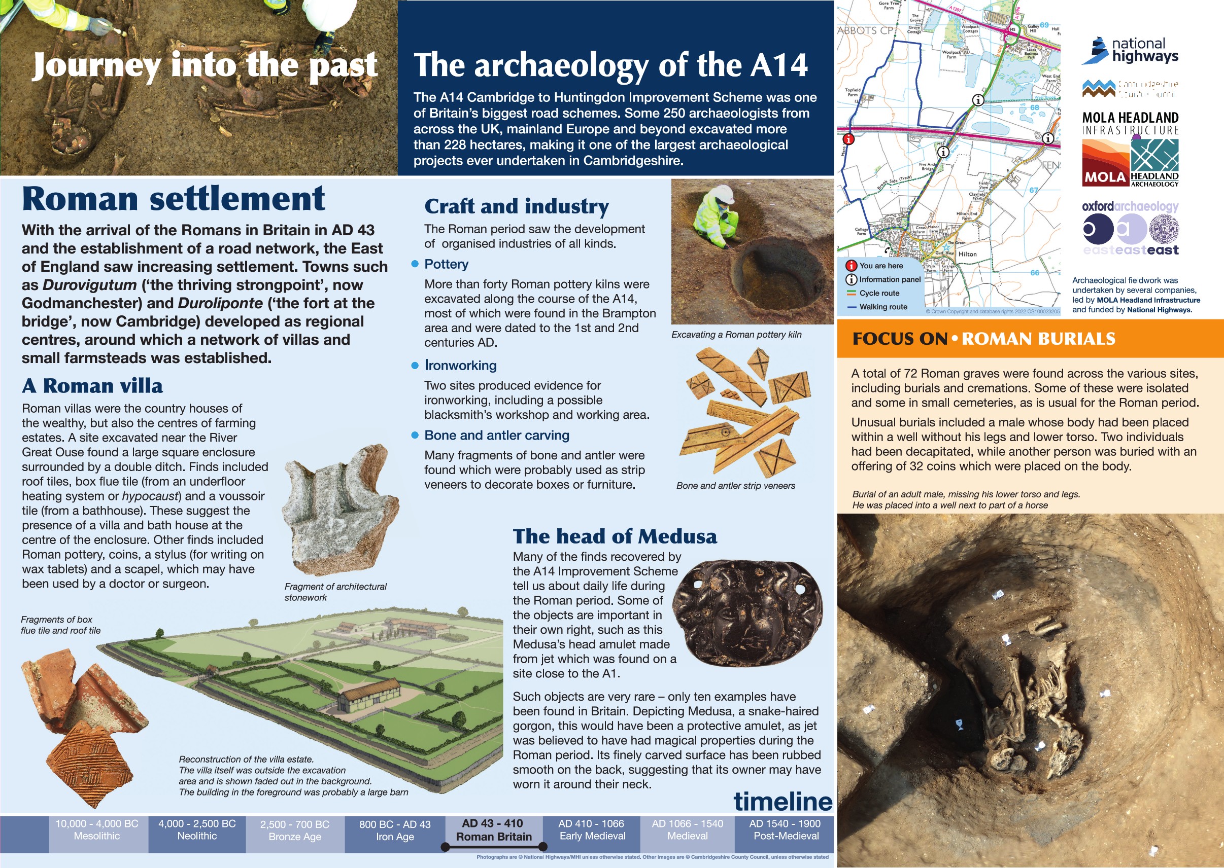
With the arrival of the Romans in Britain in AD 43 and the establishment of a road network, the East of England saw increasing activity. Towns such as Durovigutum ("the thriving strongpoint' - now Godmanchester) and Duroliponte ('the fort at the bridge' - now Cambridge) developed as regional centres, around which a network of villas and small farmsteads were established.
Roman villas were the county house of the wealthy but also the centre of farming estates. Excavations near the River Great Ouse found the northern part of a large square enclosure surrounded by a double ditch. Finds included roof tile, box flue tile (usually from an underfloor heating system) and a voussoir tile (from a bathhouse). These suggest the presence of a villa and a bath house at the centre of the enclosure.
The Roman period saw the development of many organised industries:
More than 40 pottery kilns were excavated along the course of the A14, most of which were found in the Brampton area and were dated to the 1st and 2nd centuries AD.
Two ironworking sites were also present, including a possible blacksmith's workshop.
Find out more
Cambridgeshire Historic Environment Records
Bronze Age ditch and Roman enclosures and trackway, Hemingford Abbots
Online project archive
A14 Cambridge to Huntingdon Improvement Scheme
A14 Road Trip to the past storymap
News
Revolutionary Romans and technology on the A14 Cambridge to Huntingdon improvement scheme | MOLA


