A14 Improvement Scheme - Board 15 Five Arch Bridge
Description
The A14 Cambridge to Huntingdon Improvement Scheme was led by MOLA-Headland Infrastructure (a consortium of Museum of London Archaeology and Headland Archaeology) and was funded by National Highways. These interpretation boards were installed by Cambridgeshire County Council with Oxford Archaeology East as part of a project funded by National Highways.
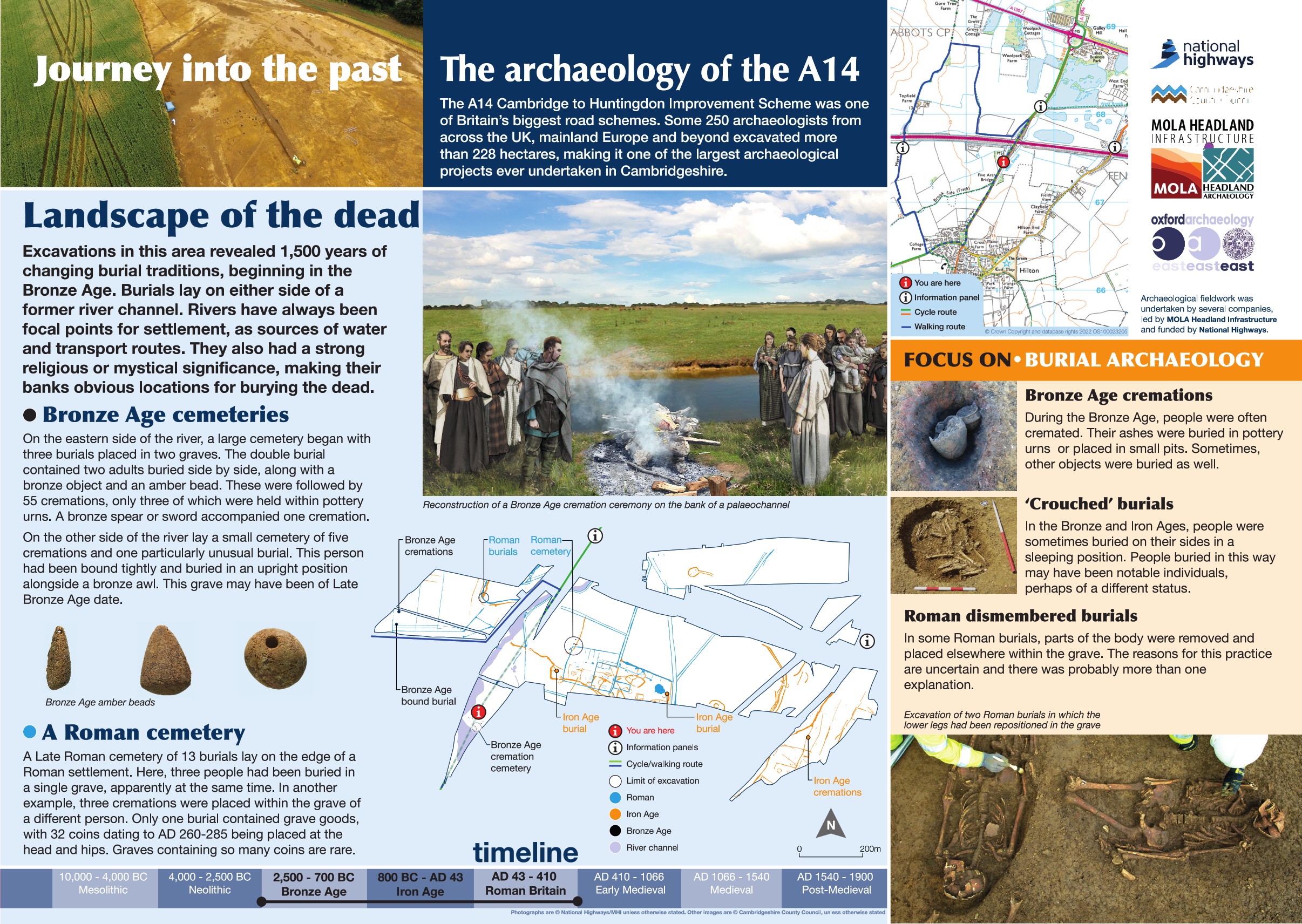
Recent excavations in this area have uncovered a fascinating story of how burial practices changed over more than 1,500 years. The earliest graves date back to the Bronze Age, when small cemeteries were laid out on either side of an ancient river channel. Burials from this period were often 'crouched' inhumations with the body laid out as though curled up in a sleeping position, or cremation burials. Bronze Age burials at this site were both inhumation and cremation burials.
One particularly unusual find was a person buried upright, tightly bound—an intriguing mystery for archaeologists. Grave goods were rare, but a few items were recovered, including an amber bead and a bronze weapon, possibly a spear or sword.
To the east of Potton Road, archaeologists identified a late Roman cemetery containing 13 individuals. This mixed cemetery included both burials and cremations. Again, grave goods were scarce, though one grave contained a small hoard of coins.
Find out more
Cambridgeshire Historic Environment Records
Bronze Age Cemetery, Fenstanton
Online project archive
A14 Cambridge to Huntingdon Improvement Scheme
A14 Road Trip to the past storymap
News
Evidence of cremation in the archaeological record | MOLA
Radiocarbon dating on the A14 Cambridge to Huntington Improvement Scheme | MOLA


