A14 Improvement Scheme - Board 31 Rectory Farm
Description
The A14 Cambridge to Huntingdon Improvement Scheme was led by MOLA-Headland Infrastructure (a consortium of Museum of London Archaeology and Headland Archaeology) and was funded by National Highways. These interpretation boards were installed by Cambridgeshire County Council with Oxford Archaeology East as part of a project funded by National Highways.
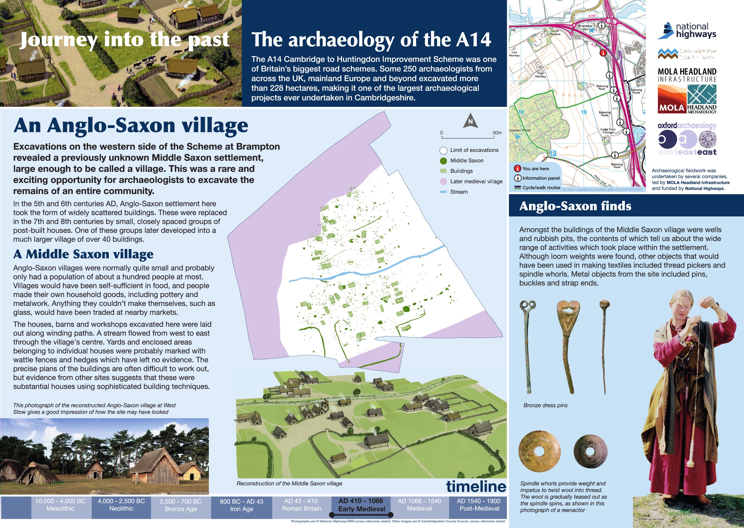
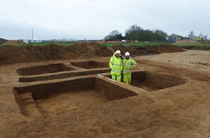
Excavations on the western side of the Scheme at Brampton revealed a previously unknown Middle Saxon settlement large enough to be called a village. This was a rare and exciting opportunity for archaeologists to excavate the remains of an entire community.
In the 5th to 6th centuries, settlement here took the form of scattered buildings but they were replaced in the 7th to 8th centuries by groups of closely spaced post-built houses. Over time, one of these groups developed into a much larger village of around 40 buildings.
The houses, barns and workshops excavated here were laid out along winding paths, a stream flow through the village centre.
Find out more
Cambridgeshire Historic Environment Records
Anglo Saxon settlement at TEA7c, Brampton Hut, Alconbury
Online project archive
A14 Cambridge to Huntingdon Improvement Scheme
A14 Road Trip to the past storymap
News
Sharing the joys of archaeology on the A14C2H Summer Community Dig | MOLA


