A14 Improvement Scheme - Board 26 Lodge Farm Cottages
Description
The A14 Cambridge to Huntingdon Improvement Scheme was led by MOLA-Headland Infrastructure (a consortium of Museum of London Archaeology and Headland Archaeology) and was funded by National Highways. These interpretation boards were installed by Cambridgeshire County Council with Oxford Archaeology East as part of a project funded by National Highways.
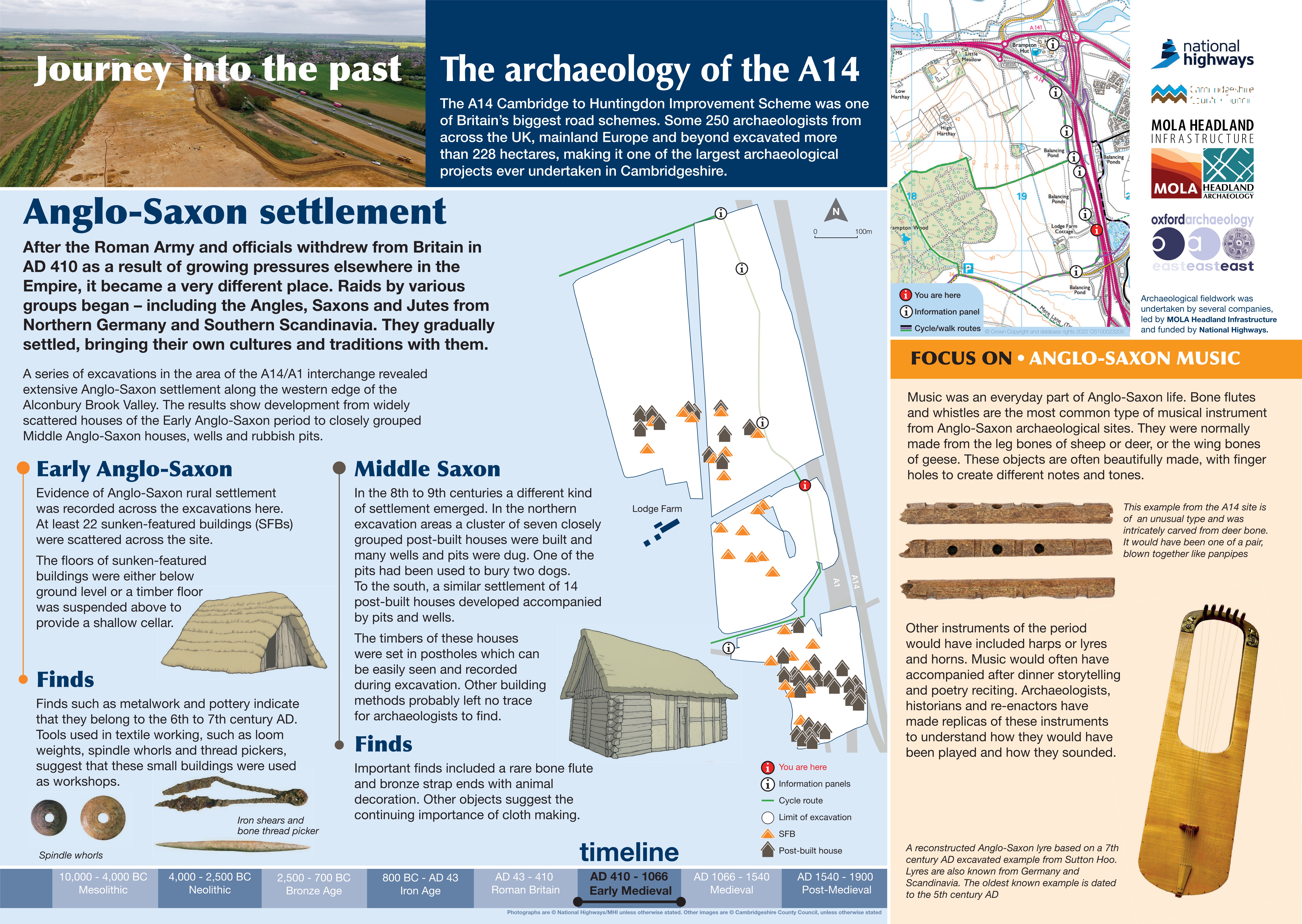
When the Romans left Britain, the landscape changed. New groups arrived from Northern Germany and Southern Scandinavia—Angles, Saxons, and Jutes—bringing their own cultures and traditions.
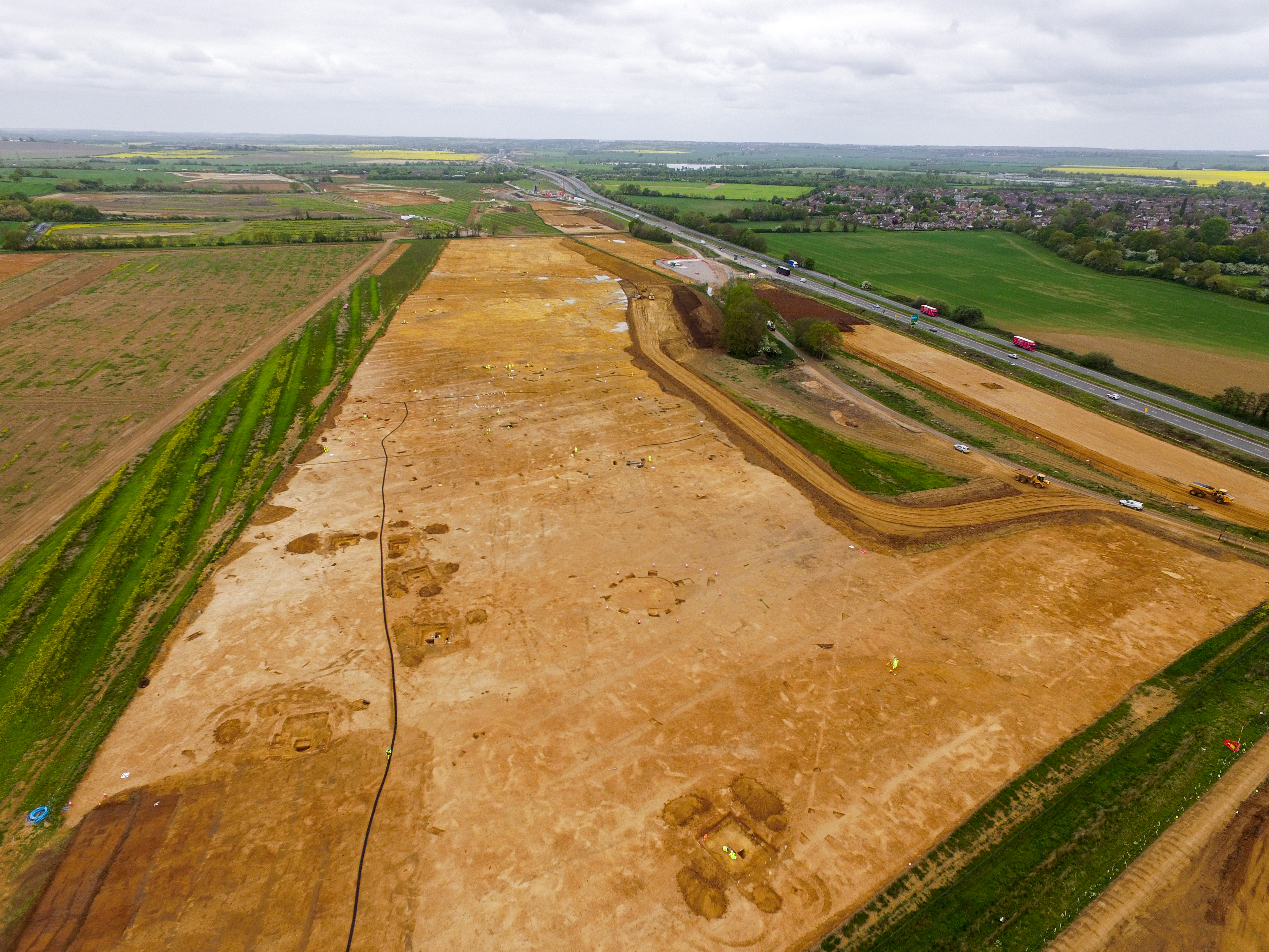
In the Alconbury Brook Valley, evidence shows extensive Anglo-Saxon settlement along its western edge. These communities developed from scattered homes in the Early Saxon period into more closely grouped villages during the Middle Saxon era.
Early Saxon settlement included 22 sunken-featured buildings spread across the site. These structures typically had floors set below ground level or shallow cellars with timber floors suspended above. Finds from this period include tools used for textile working, giving us a glimpse into everyday life.
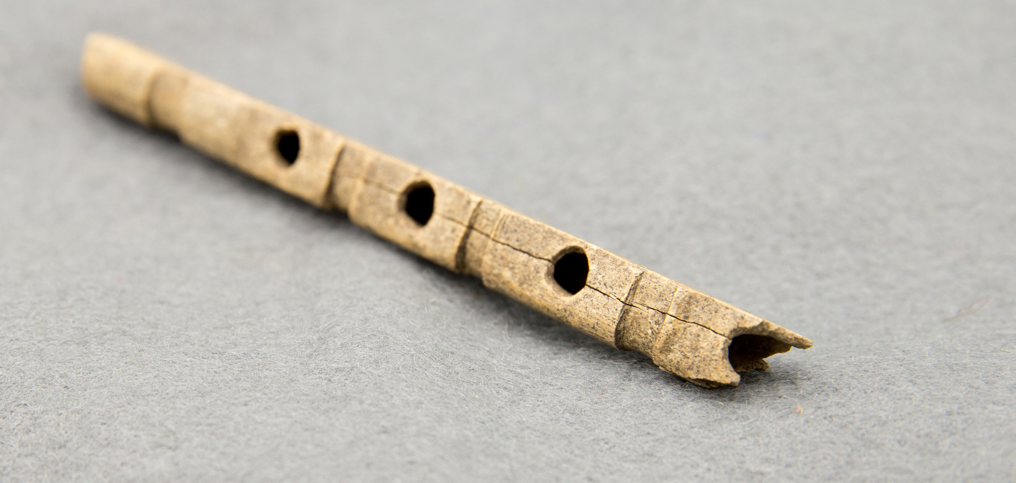
Later, building styles changed. Post-built structures replaced sunken houses, and homes began clustering together to form small settlements. Among the discoveries from this period is a rare bone flute.
Find out more
Cambridgeshire Historic Environment Records
Romano-British settlement (northern site TEA 11), Brampton
Romano-British ladder settlement, enclosures and cremations (southern site TEA 11 & 12), Brampton
Online project archive
A14 Cambridge to Huntingdon Improvement Scheme
A14 Road Trip to the past storymap
News
Revolutionary Romans and technology on the A14 Cambridge to Huntingdon improvement scheme | MOLA
A potted history of Cambridgeshire: Ceramic finds from the A14C2H | MOLA


