A14 Improvement Scheme - Board 32 Huntingdon Station monolith
Description
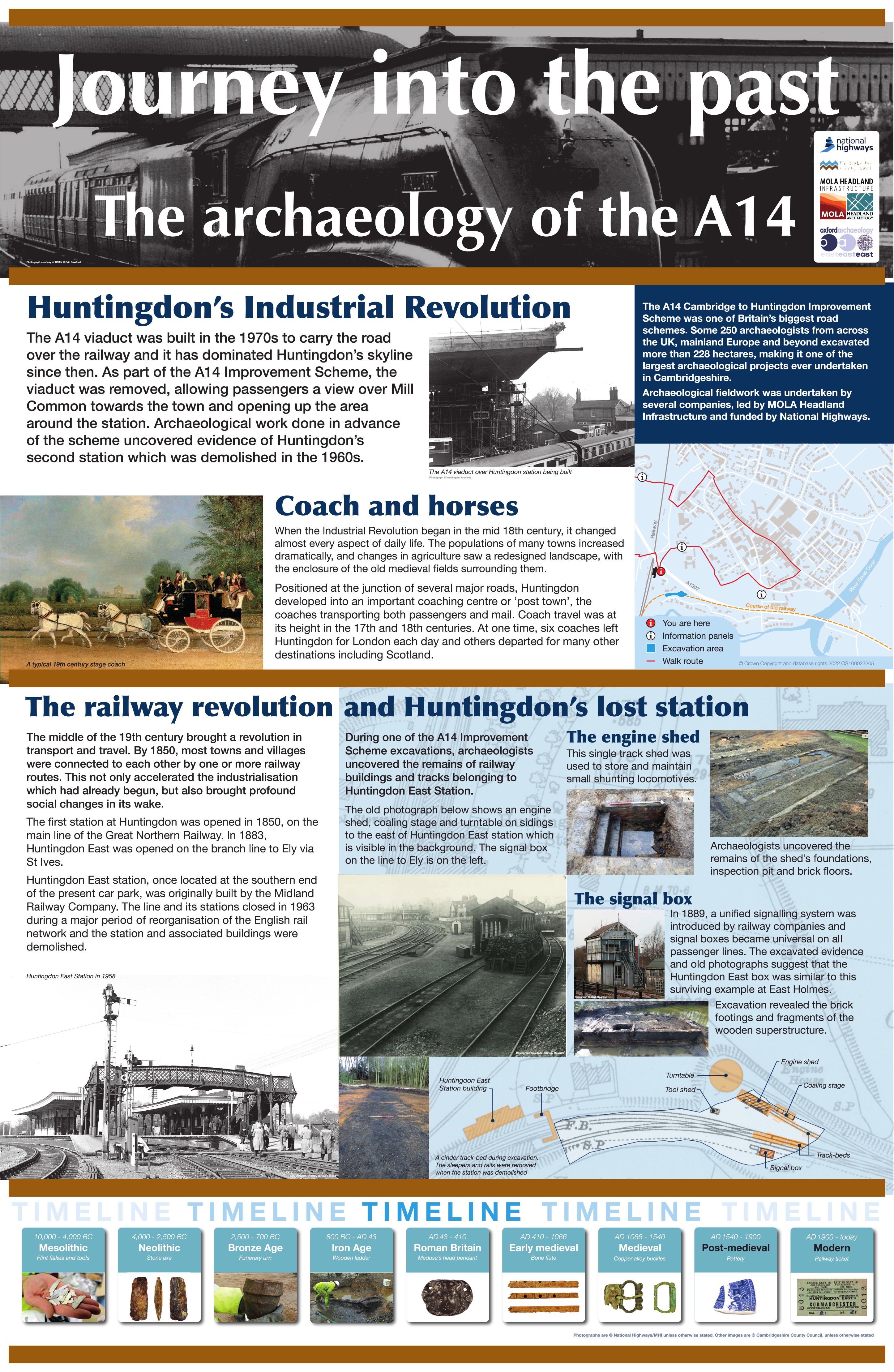
The A14 Cambridge to Huntingdon Improvement Scheme was led by MOLA-Headland Infrastructure (a consortium of Museum of London Archaeology and Headland Archaeology) and was funded by National Highways. These interpretation boards were installed by Cambridgeshire County Council with Oxford Archaeology East as part of a project funded by National Highways.
The A14 viaduct was built in the 1970s to carry the road over the railway, it dominated the skyline and the railway station of Huntingdon since then. As part of the A14 Improvement Scheme the viaduct was removed allowing passengers a view over Mill Common and opening up the area around the station.
The middle of the 19th century brought a revolution in transport and travel and by the end of the century most towns and villages were connected by at least one railway route. Urban centres, were differing routes crossed, were often served by more than one station - Huntingdon main station was opened on the Great Northern Line in 1850 with a second, smaller station known as Huntingdon East operating on the east-west line from Ely to St Ives run by the Midland Railway Company. This line was closed in 1963 and the buildings largely demolished.
Excavations to the south of the station uncovered the remains of railway buildings and tracks belonging to the former East station. A single track shed was identified including the shed foundations, inspection pit and brick floors along with the foundations of a signal box and track beds.
Find out more
Cambridgeshire Historic Environment Records
Engine house of the former New Joint Station, Huntingdon
Online project archive
A14 Cambridge to Huntingdon Improvement Scheme
A14 Road Trip to the past storymap
News
Huntingdon East, Hidden in Train Sight – the Archaeology of a Forgotten Station | MOLA

